For a weekend forecast that was a wet looking one just a few days ago, the about-face in expected weather comes as a welcome change for those with outdoor plans or who depend on fall foliage tourism – both of which look good for the vast majority of New England this weekend.
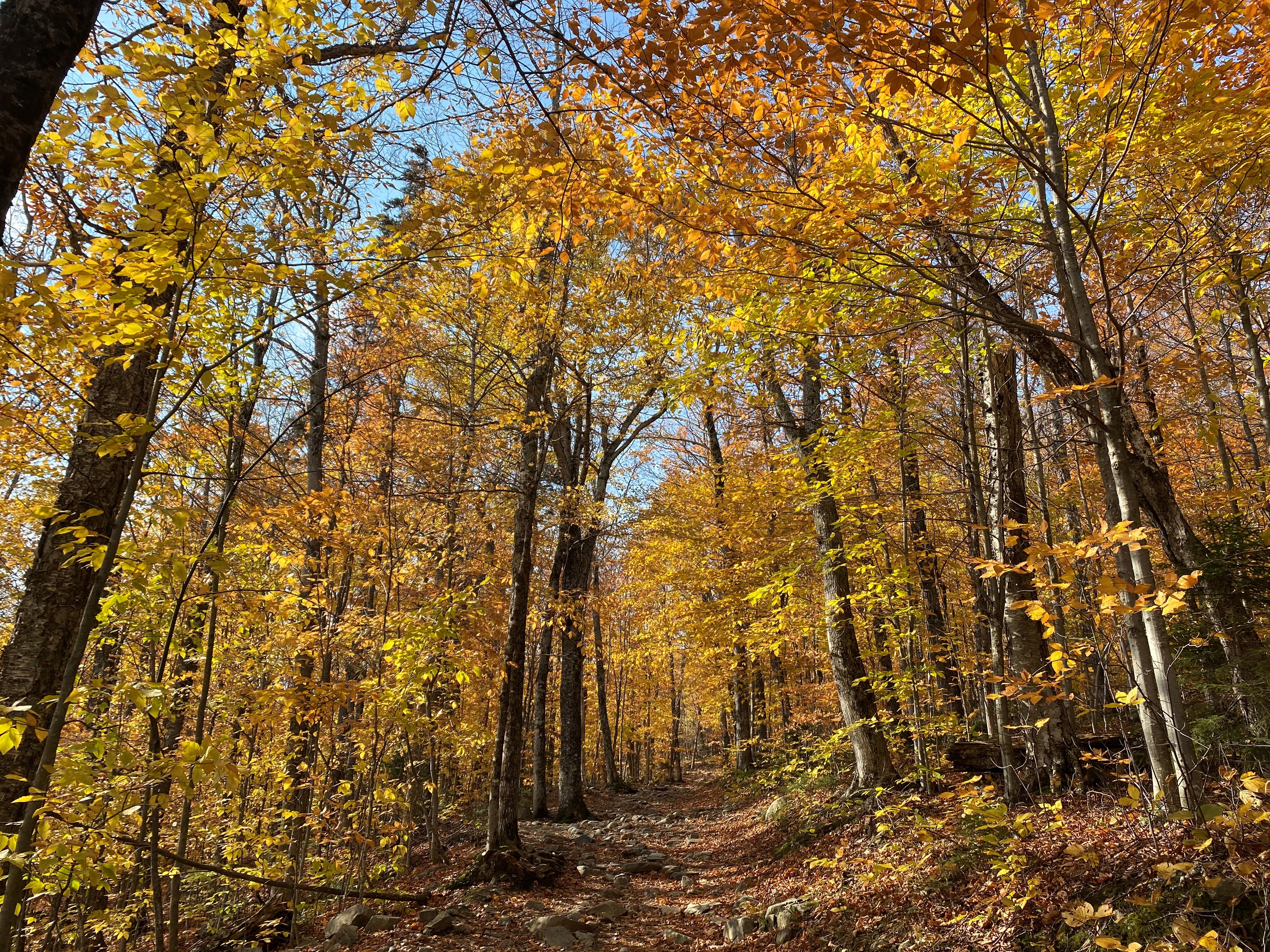
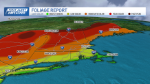
While photographers looking to capture that perfect foliage shot escape the rain for most of the weekend, lighting conditions will be variable, with varying amounts of sun and clouds both days and peak color stellar in much of northern and western New England -- and a good chunk of central New England as well, with the very farther northern reaches of New England past peak color, from Lake Memphremagog, Vermont, to the Great North Woods of New Hampshire and the Mahoosuc Range of Maine.
The “superhero” of our weather this weekend has been a bubble of high pressure – fair weather – dipping southeast out of Canada to save the day by flexing its muscle of dry, cool air, cutting steady rain off at the pass and blocking its entry to most of New England as the rain falls farther south.
Get Boston local news, weather forecasts, lifestyle and entertainment stories to your inbox. Sign up for NBC Boston’s newsletters.
Of course, rain was never in the forecast for Friday anyway, with a cool northwest wind gusting to 30 mph at times and ushering in dry air, but making high temperatures either side of 60 degrees feel like the 50s at the warmest time of day.
The wind won’t totally quiet overnight Friday night, so low temperatures in the 40s for most and upper 30s in cooler spots will feel like the 30s with the wind chill factor, and though the breeze will be lighter Saturday and Sunday than Friday’s wind, we’ll still feel a light and steady breeze.
Saturday morning sunshine will fade behind increasing clouds as the day rolls on, but some spots will still be able to see the sun by midday, when the partial “annular eclipse” gets underway – not really a show here in New England with a maximum of about 17% of the sun obscured at 1:26 p.m., but if you have a pair of eclipse glasses left over from the last eclipse, some of us may be able to catch a glimpse. The better bet may be to catch a livestream online from NASA!
As for the rain, over an inch of rain will fall this weekend from Cleveland, Ohio, to New Jersey, but in New England showers won’t reach farther north than Fairfield County, Connecticut, by midday Saturday, Hartford to Providence by Saturday early evening and it may dance across the Cape and Islands late Saturday evening into early Sunday morning before retreating south again. There’s also a higher chance of showers farther north, beneath a pool of cold air aloft that prompts showers near the Canadian border Friday, Saturday and Sunday afternoon.
By later Sunday, some of that cold air aloft starts to bleed southward, and isolated showers may develop as far south as the Massachusetts Turnpike by late in the day, but most of the day will be enjoyable for most communities in New England.
Next week starts cool, with an increased chance of scattered showers Monday and Tuesday, then lingering cool air Wednesday before a slight rebound back to the 60s at the end of the week in our exclusive First Alert 10-day forecast.