Hope you enjoyed your Fourth of July celebrations. There were no record-breaking temperatures yesterday:
- Boston 68° (Normal 81°)
- Worcester 68° (Normal 79°)
- Hartford 76° (Normal 85°)
- Providence 70° (Normal 83°)
WATCH ANYTIME FOR FREE
Stream NBC10 Boston news for free, 24/7, wherever you are. |
After a 4th with scattered showers and sun, temperatures rebound to the mid 70s on Monday. We’ll enjoy mostly sunny skies with calm wind to start and out of the south this afternoon.
Do expect for the humidity to increase as of today, fortunately not overwhelming. With this said, Tuesday will be a different story.
Get updates on what's happening in Boston to your inbox. Sign up for our News Headlines newsletter.
Meanwhile, overnight Monday night into Tuesday, an approaching warm front will bring an increase in moisture and warmer temperatures. The humidity will continue to rise with dew points in the mid 60s, and we cannot rule out some scattered showers to the north.
As we head into Tuesday and Wednesday, heat indices will increase that could give way to heat advisories. This unstable air will allow the risk for widely scattered strong to severe storms Tuesday and Wednesday northwest of Interstate-95. Main threats with these storms will be damaging wind and heavy rain. Wednesday is looking more like a heavy-rain storm event.
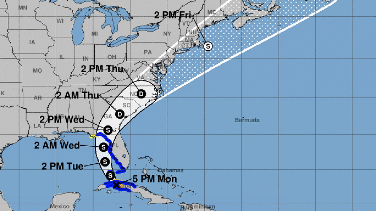
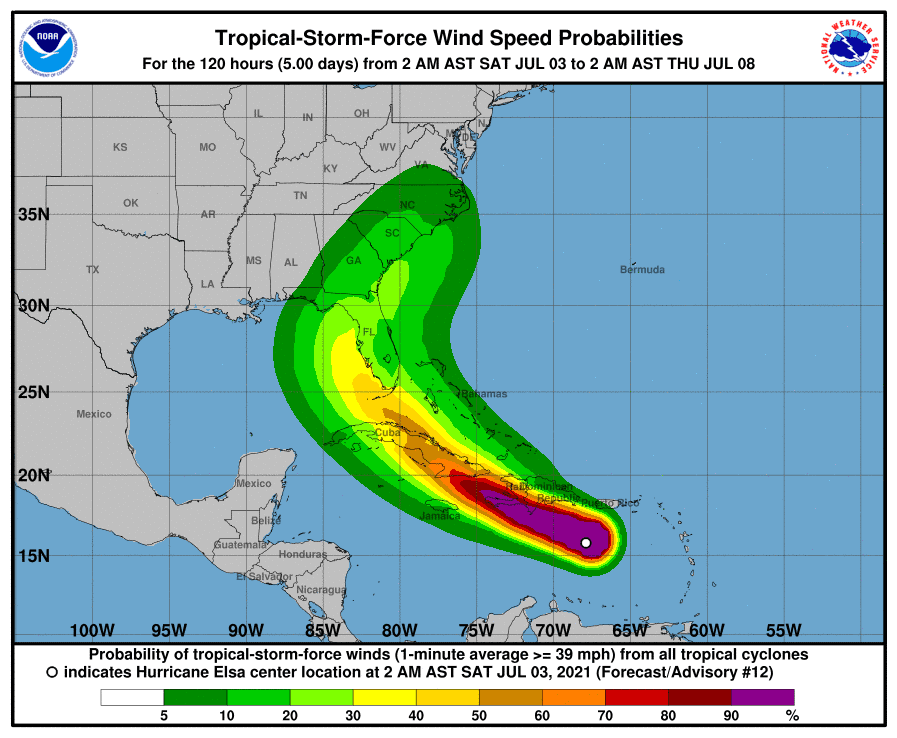
Latter part of the week, we could be encountering Elsa. The question is “Will Elsa Let Go of New England” and just be on her merry way over the open waters of the Atlantic? Thursday and Friday, we’ll have a cold front stalling in the vicinity that may interact with Elsa or its remnants. At this time, there is uncertainty on Elsa’s track and the interaction with this front.
Looking into next weekend, it's a more seasonable to start with warmer temperatures and more humidity on Sunday.