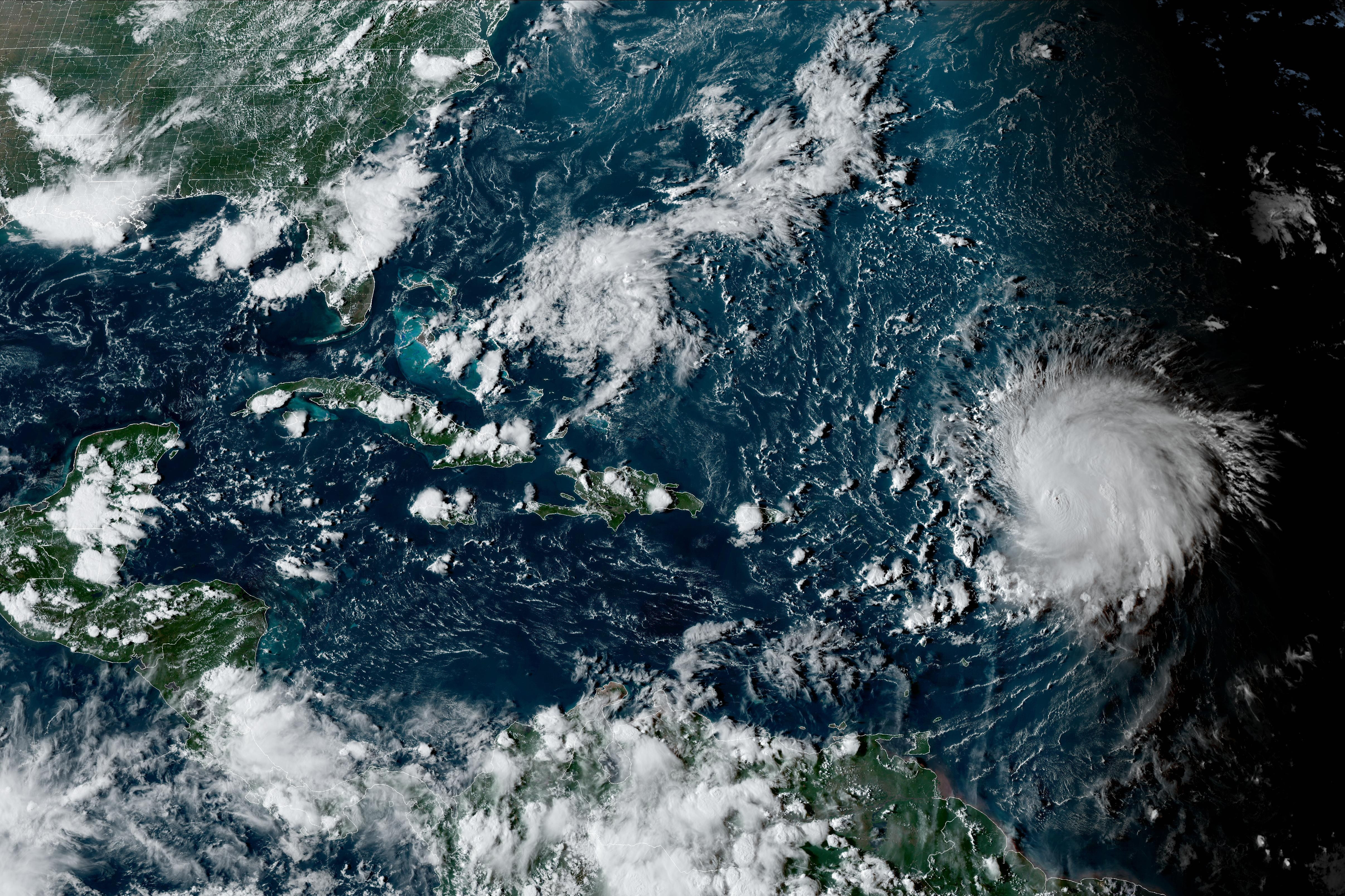
Hurricane Lee began to spin away from the northern Caribbean on Wednesday as the Category 3 storm aimed for Atlantic Canada and coastal New England, leaving big waves in its wake.
The storm was located about 475 miles south-southwest of Bermuda in the morning. It had winds of up to 115 miles per hour and was moving northwest at 6 mph.
Lee was expected to eventually pass just west of Bermuda, prompting forecasters to issue a tropical storm watch for the island. Wind and heavy rainfall were expected to lash Bermuda starting late Wednesday or early Thursday, forecasters said. It is then expected to keep traveling north and lose strength in cooler waters before potentially making landfall over the weekend in Nova Scotia, Canada, as a possible tropical storm.
Get Boston local news, weather forecasts, lifestyle and entertainment stories to your inbox. Sign up for NBC Boston’s newsletters.
When is Hurricane Lee supposed to hit?
“There is an increasing risk of wind, coastal flooding and rain impacts from Lee in portions of New England and Atlantic Canada beginning on Friday and continuing through the weekend,” the National Hurricane Center said. “Watches may be required for portions of these areas later today or tonight. Due to Lee's large size, hazards will extend well away from the center, and there will be little to no significance on exactly where the center reaches the coast."
What is Hurricane Lee's projected path?
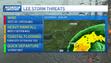
So far, the forecasts have not consolidated around a track with Lee. While that could happen in the coming days, if they do not, then it may go down to the wire. Right now, the worst-case scenarios paint very strong winds on the coast, and up to one to four inches of rain. While the tracks farther east show lower wind speeds along the coast and less than an inch of rain.
The storm is predicted to weaken slowly, and it's still expected to pass southeast of Nantucket. The cone of uncertainty gets smaller as you get closer in time to when the storm will pass by Massachusetts, but that cone shifted west during the early morning update.

Could Hurricane Lee make landfall in Maine?
The center of the cone would mean a landfall of tropical storm strength system in eastern Maine by the time we get to overnight Saturday night. There is still a cone of probability that goes all the way to Halifax, Nova Scotia, and easteward right along our eastern coast.
The National Weather Service in Gray, Maine, said it is closely monitoring Hurricane Lee and its potential impacts on Maine and New Hampshire coastline.
"It is this proximity to the coast that will govern the level of impacts experienced across western ME and NH," the National Weather Service said. "Impacts will be felt far away from the center though as the wind field continues to grow. Lee will bring rough surf conditions to beaches through this weekend."
"This will result in a high risk of rip currents. Beyond this, it remains too early to determine if this hurricane will have any other direct impacts across NH and western ME. There is increasing confidence for a period of gusty to strong northerly winds though."
How strong will the winds be?
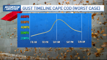
The most likely scenario, according to NBC10 Boston chief meteorologist Matt Noyes, is that the wind will shift near and start shfting to the east of the track, which would put 40-50 mph gusts right at our coast, and 20-40 mph when you come futher inland.
But if you take the average overnight guidance, it actually gives 60-70 mph gusts on the coast and 70-80 mph on the outer Cape. Seas of 10-15 feet are also expected by Friday afternoon. A change in storm structure lowers these, and a change in storm structure is expected. But the region should remain on guard, particularly based on the average available guidance that has come in.

From four days out, marinas should continue preparations in case they need to secure vessels, utility companies should be reviewing their coastal storm plans, coastal residents should make flexible plans and closely monitoring for forecast updates.
By Saturday evening, the storm should be gone for all of us.
The Associated Press contributed to this report.


