
It didn’t break the record of 42 degrees, but the 33 degree jump in high temperature from Saturday’s 18 degrees in Boston to Sunday’s 51 degrees certainly was incredible and evidence that cold this year is fleeting – even when it’s intense.
On the larger picture, this is very close, if not exactly in line, with what our First Alert Team shared with you in our Climate Special this past fall – a warmer than normal setup with brief shots of intense cold, then a return to warmth. This is, to a large extent, the calling card of the modern winter in a climate-changed atmosphere, where the intense arctic cold of the North Pole breaks into pieces, diving southward at times with intensity but is surrounded by warmer-than-normal air.
Our First Alert 10-day forecast features that return to warmth promptly, with only two of the upcoming ten days – this Tuesday and Sunday - near normal for temperature and the rest milder-than normal.
Get Boston local news, weather forecasts, lifestyle and entertainment stories to your inbox. Sign up for NBC Boston’s newsletters.
In this return to a milder pattern, we’re also returning to a weather pattern that will drop occasional snow on northern New England, with ski and snowmobile country forecast by our exclusive NBC Forecast System to pick up another 4 to 10 inches of snow, depending on location, over the next seven days.

Monday features a major ocean storm southeast of New England, set to strengthen sufficiently to develop an eye-like feature at its center and increase the northerly wind over eastern New England Monday afternoon to gusts of 30 mph for many and as high as 45 mph on Cape Cod. That will create a wind chill in the 30s instead of actual highs in the 40s by late day, and dragging enough cold air southward from eastern Canada to drop Monday night lows into the single digits and teens north and 20s south with a wind chill about 10 degrees colder.
Weather

Clouds Monday on the northwest periphery of the ocean storm will outweigh sun for New England, then gradually clear Monday night for some limited morning sun Tuesday before the next disturbance, approaching from the west, fills clouds back in during the afternoon.
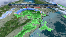
Tuesday evening and night will bring mixed snow and rain showers from that quick-moving disturbance, dropping one to two inches of snow in the North Country, but little more than a coating or just raindrops farther south. Fair weather and rebounding temperatures Wednesday come ahead of the next disturbance slated for the end of the week, with late day rain showers Thursday lasting through Friday with high temperatures in the 50s for southern New England and into early Saturday morning, though falling as snow and adding a new two to five inches of snow in the North Country.
More snow showers are expected this weekend in the mountains, while central and southern New England are likely to dry out after early Saturday morning with temperatures dipping near normal Sunday before rebounding, yet again, to start next week.
