
We have a very wintry-feel to this weekend as temperatures remain well below normal.
This morning our lows have dropped to the single digits, teens and 20s with wind chills making it feel as cold as -20 degrees across the north country. The wind slowly subsides today, to a light breeze by Sunday.
WATCH ANYTIME FOR FREE
Stream NBC10 Boston news for free, 24/7, wherever you are. |
Even with the strong March sun angle, our highs will only be in the 20s to low 30s today and tomorrow. Sunday will feel better since the wind won't be as strong.
Get updates on what's happening in Boston to your inbox. Sign up for our News Headlines newsletter.
Off-and-on clouds meander through all weekend, as well. Mountains and ski areas across northwestern New England will also see the continuation of upslope light snow or flurries through today.
Gradually, our temperatures start to warm up a bit early next week. A lot of warm air is bottled up to our southwest and the jet stream is blocking this dome of heat from the northeast this weekend.
That changes next week as slowly the dome of heat builds enough to push the jet stream farther north and even into Canada by late next week. This allows for our temperatures to really warm to the 50s and 60s by midweek next week.
Highs will be in the 40s for Monday, 50s Tuesday, then near 60 to the mid 60s Wednesday into Thursday (a little cooler for northern New England), and some of southern New England may stay warm into Friday, before a cold front heads through.
Weather Stories

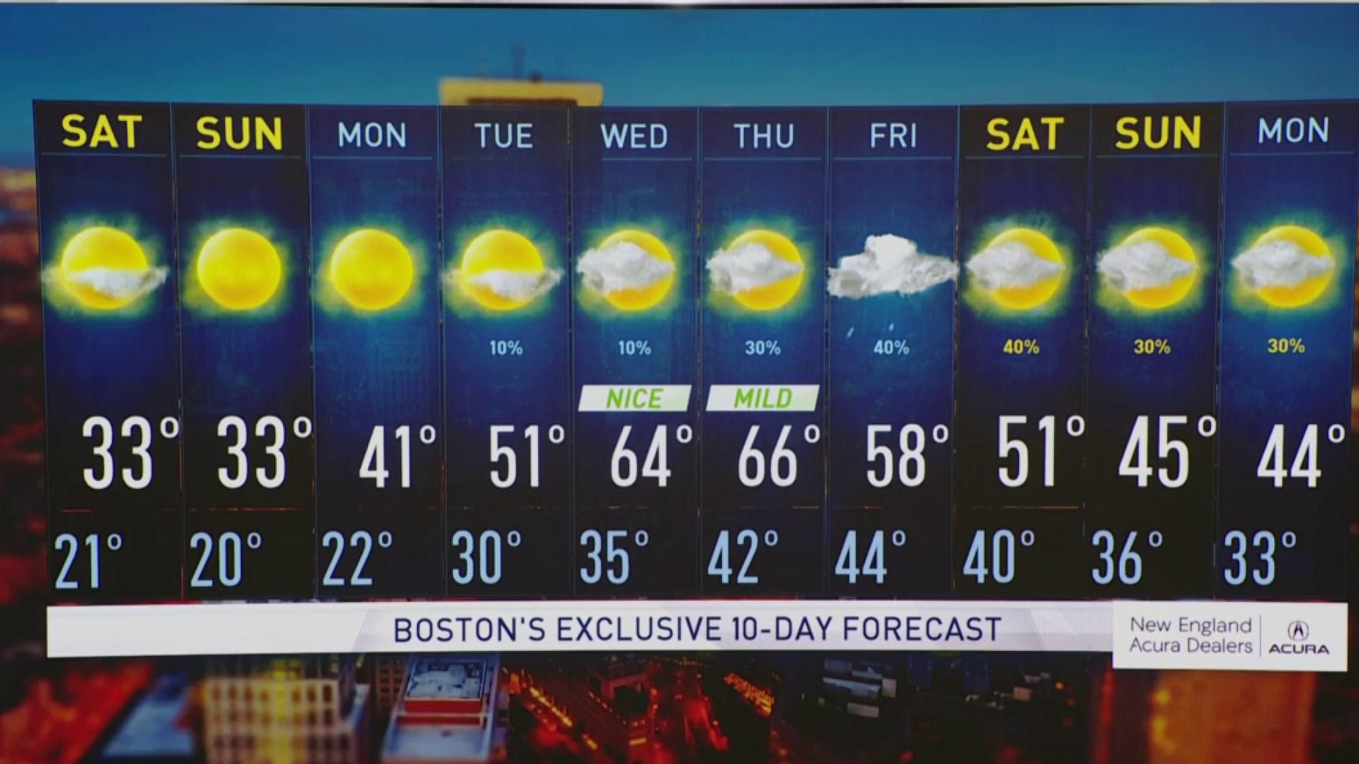
We do get more active for next week as a frontal boundary approaches some time Thursday. Scattered rain is likely, then showers for Friday, to showers changing to snow showers possibly in northern New England as we head into next week. Stay tuned!