By now you probably have heard that there is some summer-like warmth on the way! This is true for inland communities first, then the coastal communities will eventually see some summer heat by the weekend.
A strong coastal storm is spinning off the Carolinas and this northeasterly airflow is influencing the southern and eastern parts of New England for a couple more days. There’s plenty of sun, but just like on Sunday, we have a continued gusty northeast wind and a cool marine influence.
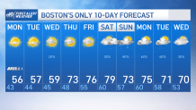
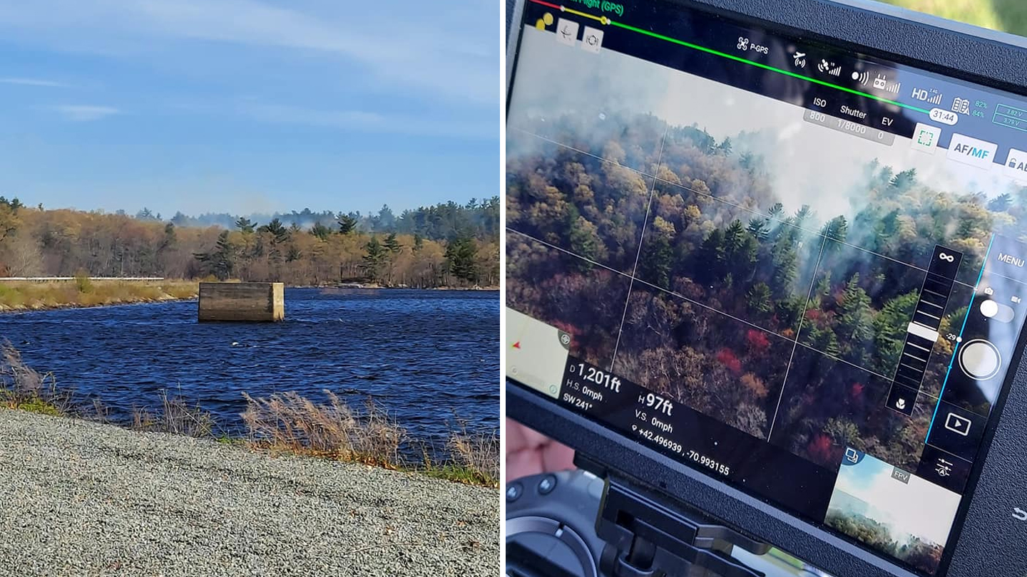
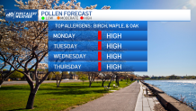
Highs today will be in the low 50s at the coast and in Boston. Away from the coast and farther northwest is where the temps start to build and that’s where highs today top off in the 60s. With the gusty wind, low humidity and dry weather, we have another day of a high wildfire or brush fire risk and also a very high pollen count.
Get updates on what's happening in Boston to your inbox. Sign up for our News Headlines newsletter.
Get Boston local news, weather forecasts, lifestyle and entertainment stories to your inbox. Sign up for NBC Boston’s newsletters.
Highs tomorrow and Wednesday will again be in the 50s at the coast and the 60s to near 70 inland. Some low clouds and drizzle may develop at the coast Tuesday night into Wednesday.
Thursday and Friday our northeast influence breaks down a bit and we all enjoy highs in the 70s to low 80s. Sea breezes at the coast will keep those spots cooler from time to time. The warm temps are here to stay through the weekend, with even some thunderstorm chances. Stay tuned!