We had a warm afternoon Wednesday with highs reaching the 40s to low 50s in southern New England thanks to a gusty wind. It stayed damp though, with scattered rain showers off and on. The showers taper from west to east this evening, heading offshore after dinnertime.
Wednesday night lows drop to the 20s north and 30s south so watch for icy spots. Thursday we have a break in storms as high pressure briefly takes over and the sky clears a bit. We are expecting some sunshine early in the day, with clouds rolling in by nightfall. Highs reach the upper 30s to lower 30s far north. A system is moving through the far north country, so watch for snow showers there and in higher terrain.
WATCH ANYTIME FOR FREE
Stream NBC10 Boston news for free, 24/7, wherever you are. |
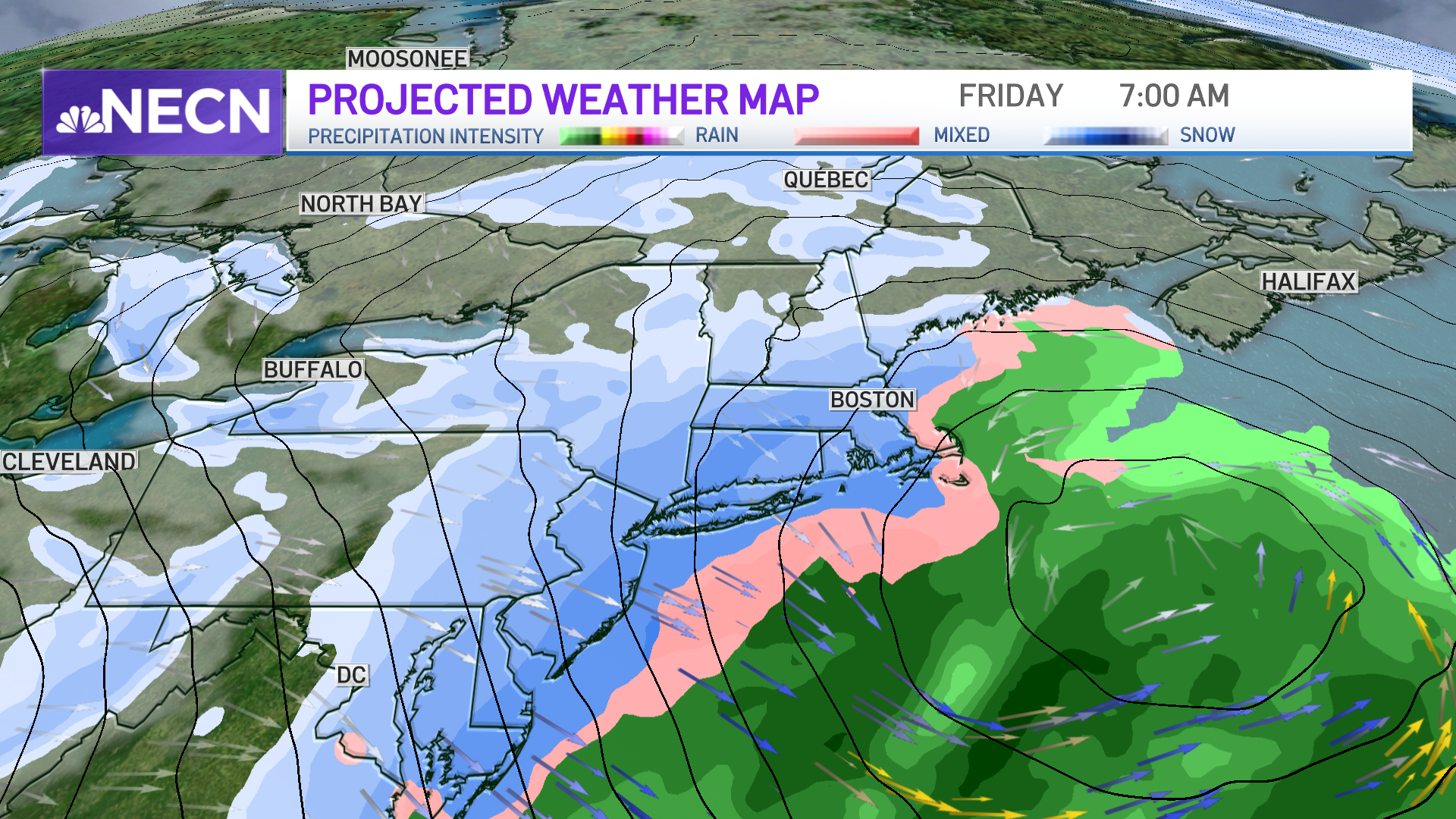
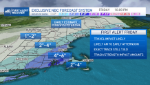
Friday brings in a winter storm and a First Alert day for snow. The forecast models are in agreement that we will see plowable snow for Boston and much of New England.
Get updates on what's happening in Boston to your inbox. Sign up for our News Headlines newsletter.
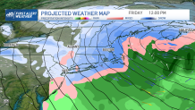
We also see agreement on a quick-moving storm, impacting the Friday morning commute the most. We are uncertain on the track or where the rain/snow line will set up. This will affect our snow totals and who could see more snowfall versus rain.
For now, several inches of snow is expected for Boston (4-6”+ roughly), and 1-4” in northern and western New England. Stay tuned for updates on this storm and snow totals. Any wobble in the track could have a significant impact on how much snow Boston will get. We do not expect damaging wind gusts or coastal flooding issues from this one.
The weekend is split with a cold and sunny day Saturday as highs stay in the 20s. Sunday we jump into the low 40s with scattered rain showers. We see a signal of significant cold especially around Tuesday, with some of the coldest temps this season. More sun and dry weather sets up for most of next week.