
-
Weather forecast: Cold wind blows
Thursday night: Clear with a wintry wind. Lows around 20, wind chill single digits. Friday: Sun to increasing clouds, less wind. Highs around 40. Saturday: Rainy, breezy. Northern New England winter storm. Highs in the 40s, 50s south.
-
Cold night, chilly Friday ahead for Boston
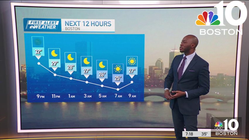
Thursday evening: Blustery, clear, a few flurries and northwest gusts to 40 mph. Temps in the 30s, wind chill 20s. Overnight Thursday night: Clear with a wintry wind. Lows around 20, wind chill single digits. Friday: Sun to increasing clouds, less wind. Highs around 40. Saturday: Rainy, breezy. Northern New England winter storm. Highs in the 40s, 50s south.
-
Weather forecast: Cold and windy, with temps feeling like 10 to 20 degrees
Thursday: Blustery with fair sky, a few flurries and northwest gusts to 40 mph. Highs in the 30s, wind chill 20s.
Overnight Thursday night: Clear with a wintry wind. Lows around 20, wind chill single digits.
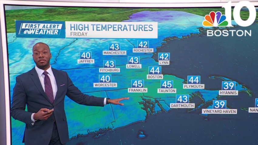
Friday: Sun to increasing clouds, less wind. Highs around 40.
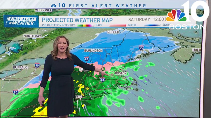
Saturday: Rainy, breezy. Northern New England winter storm. Highs in the 40s, 50s south. -
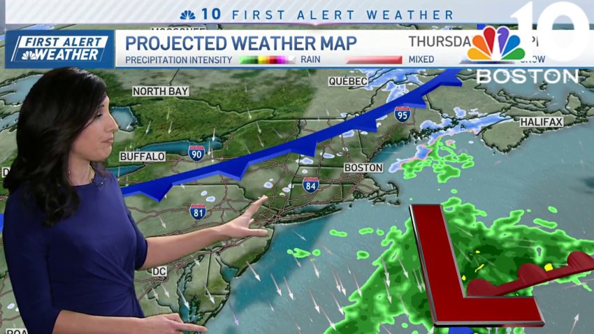
Wintry weather returns, heavy snow in northern New England this weekend
Winter has returned in full force on Thursday with gusty west winds, wind chills in the teens and 20s, highs in the 30s, and some lingering flurries. More specifically, in Maine we continue to see the low pressure system slowly move out Thursday, but lingering snow showers continue to coat untreated backroads with fresh snow. The morning flurries across...
-
Blustery in Boston Thursday, with wind chills in the 20s
Thursday: Blustery with fair sky, a few flurries and northwest gusts to 40 mph. Highs in the 30s, wind chill 20s.
Overnight Thursday night: Clear with a wintry wind. Lows around 20, wind chill single digits.
Friday: Sun to increasing clouds, less wind. Highs around 40.
Saturday: Rainy, breezy. Northern New England winter storm. Highs in the 40s, 50s south. -
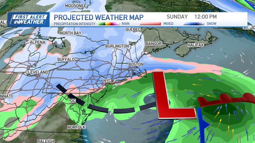
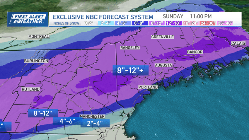
How much snow are we getting Sunday? What to expect from this weekend's storm
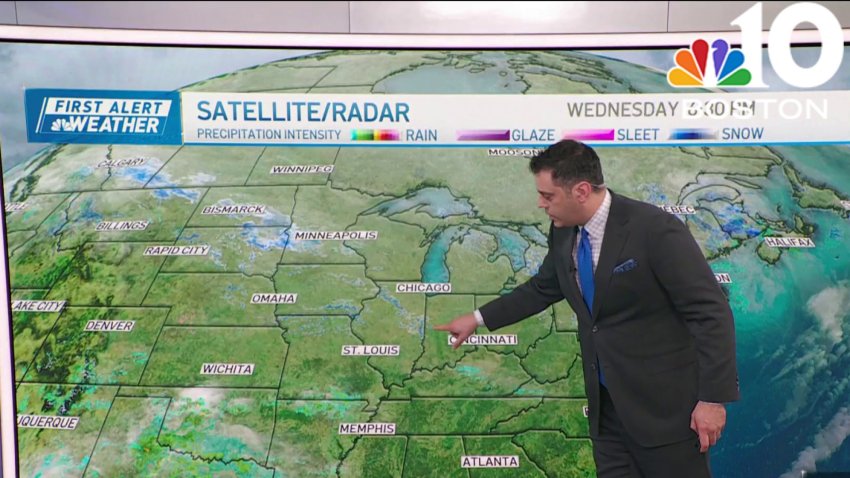
Our quiet stretch continues with a blend of sun and clouds and highs in the low 40s for many of us Wednesday afternoon. Wednesday night, we’ll drop into the 20s under partly cloudy skies and some snow showers in far northern New England. As a cold front sweeps through the region from northwest to southeast Thursday, scattered snow showers...
-
Wednesday stays quiet for the rest of the day, clouds increase tonight
Wednesday: AM clouds, PM sun. Highs 40-45.
Overnight Wednesday night: Clouds fill in. Lows around 30.
Thursday: Mostly cloudy, sprinkles/flurries, cold wind late. Highs around 40.
Friday: Cold sun. Highs in the 30s. -
Sunny and quiet Wednesday, with temps in the 40s
Wednesday: AM clouds, PM sun. Highs 40-45.
Overnight Wednesday night: Clouds fill in. Lows around 30.
Thursday: Mostly cloudy, sprinkles/flurries, cold wind late. Highs around 40.
Friday: Cold sun. Highs in the 30s.
Trending
