
-
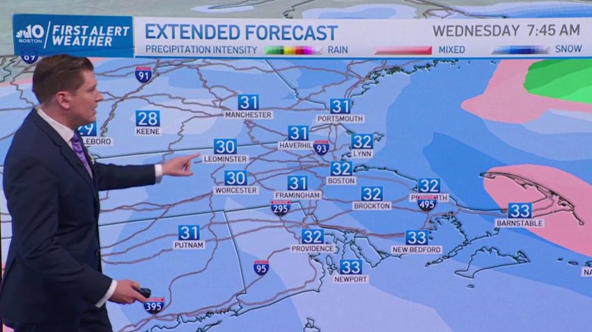
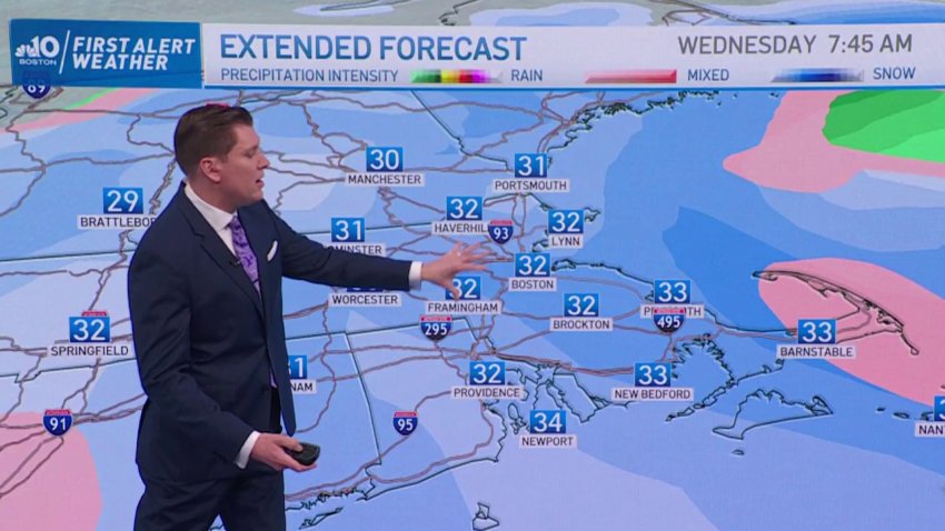
Developing Nor'easter Could Bring Power Outages, Worries for Coast
Sunday and Monday are expected to be seasonably cold and dry. It’s Monday evening into Tuesday where we see a power winter storm arrive. Beginning as rain for most of the region on Tuesday, dropping temperatures into Tuesday evening will provide a blanket of heavy snow throughout the entire region.
-
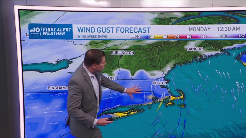
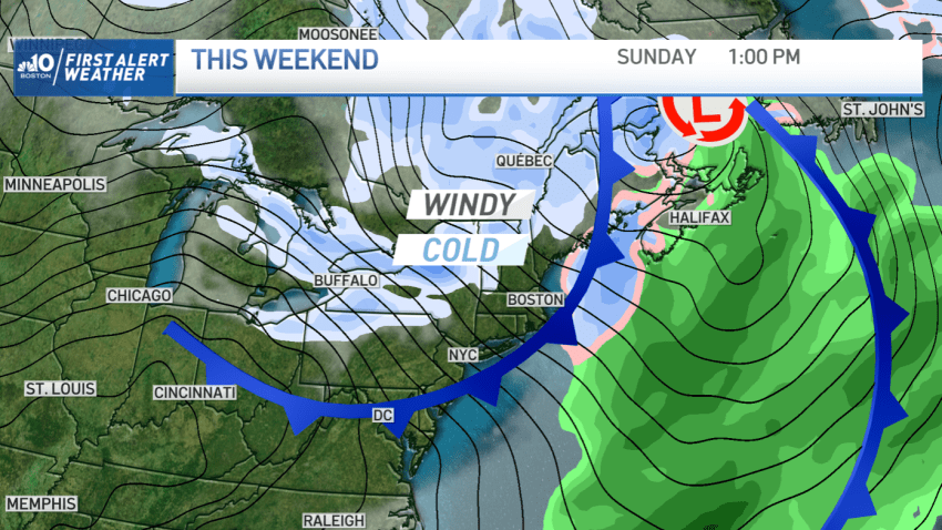
Quiet, Cloudy Weekend Ahead of Nor'easter
Tonight (Saturday) and Sunday will be cloudy and quiet for most of the region, only for a Nor’easter to make its way starting on Monday, and ending Wednesday. Heavy snow is expected, along with high winds which could impact coastal areas and bring power outages throughout the region.
-
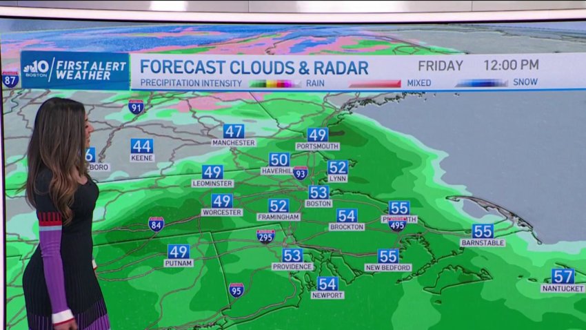
Forecast: Afternoon Rain to Disrupt Post-Holiday Commute
Tonight: Mostly clear, lows in upper 30s inland, around 40 in Boston. W wind. Tomorrow: Growing clouds, showers around midday onward through overnight. Highs in low to mid-50s.
-
Forecast: Wintry Mix in Parts of the Region
Today: Cloudy AM, showers by late AM. Highs in the low 50s, becoming breezy. Tonight: clearing skies, lows in the upper 30s, windy. Tomorrow: Pick of the weekend, gorgeous sunny day. Highs around 50.
-
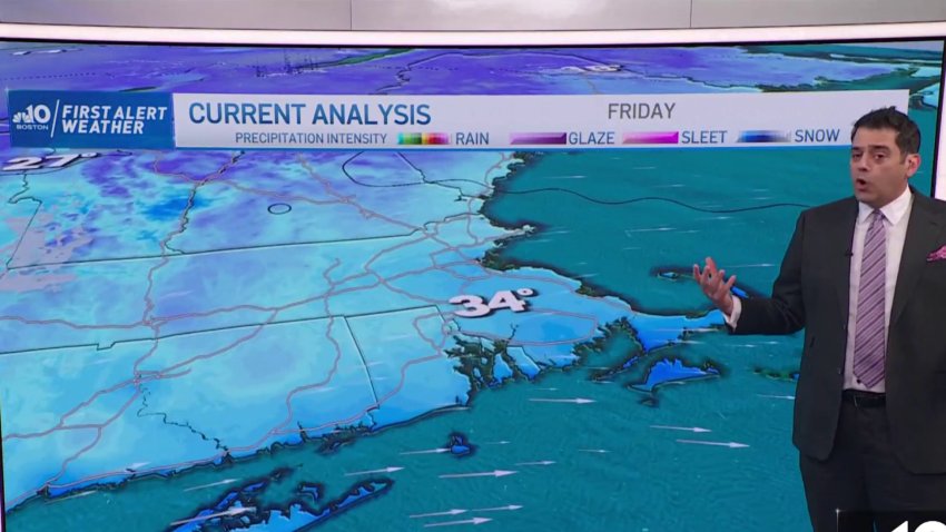
Arctic Front Brings Subfreezing Temperatures This Weekend
The cold continues to hold temps in the 40s over the next two days. While not bitter, it’s keeping us below normal and allowing for billowing afternoon clouds with the colder air aloft. That same setup over the relatively warm waters (40s and 50s) of the Great Lakes is producing prolific – and perhaps record-setting – snowfall. Buffalo was hammered…
-
Arctic Front Moves in This Weekend
Friday: Highs in low-40s. Sunny AM, passing clouds PM, ocean-effect showers in south shore. Snow squalls possible inland (late evening). Saturday: Highs in low 40s, mostly sunny, southwest wind.
Trending
