
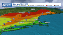
A pleasant autumn day is ahead, with a good amount of sunshine and temperatures closer to average. It's a great day to get out there and enjoy the foliage, especially across northern New England, where we are seeing peak colors.
A large upper level system over the Great Lakes will continue to influence our weather the next couple days with a couple weak disturbances rotating around it bringing the risk for showers to the region Tuesday and across northern areas Thursday.
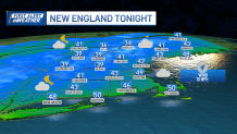
After a chilly start with some inland valley fog, temperatures will recover nicely, with afternoon high temperatures in the mid 50s to 60 north, around 60 south. Overnight clouds will be on the increase, but we should stay clear enough north to allow our temperatures to drop into the 30s along with some patchy frost and valley fog.
Get Boston local news, weather forecasts, lifestyle and entertainment stories to your inbox. Sign up for NBC Boston’s newsletters.
A few showers are possible across the Cape and Islands late Monday night. Temperatures in southern areas will be mostly in the 40s with a few 30s in the traditionally colder spots.
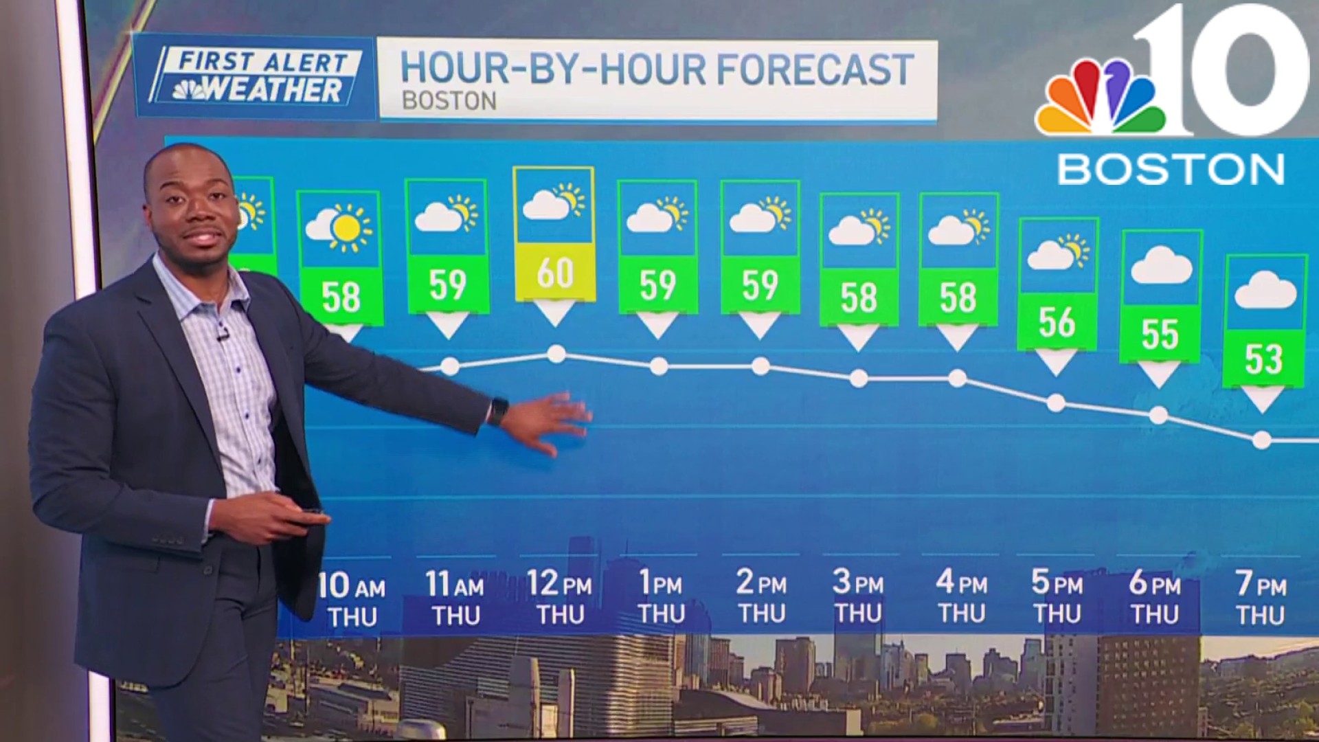
More in the way of clouds Tuesday as a weak disturbance moves through the region. Much of the day will remain dry, but a few showers will pop up from time to time, especially across the Cape and Islands. Temperatures will be close to seasonable with highs in the 50s and 60s.
Weather
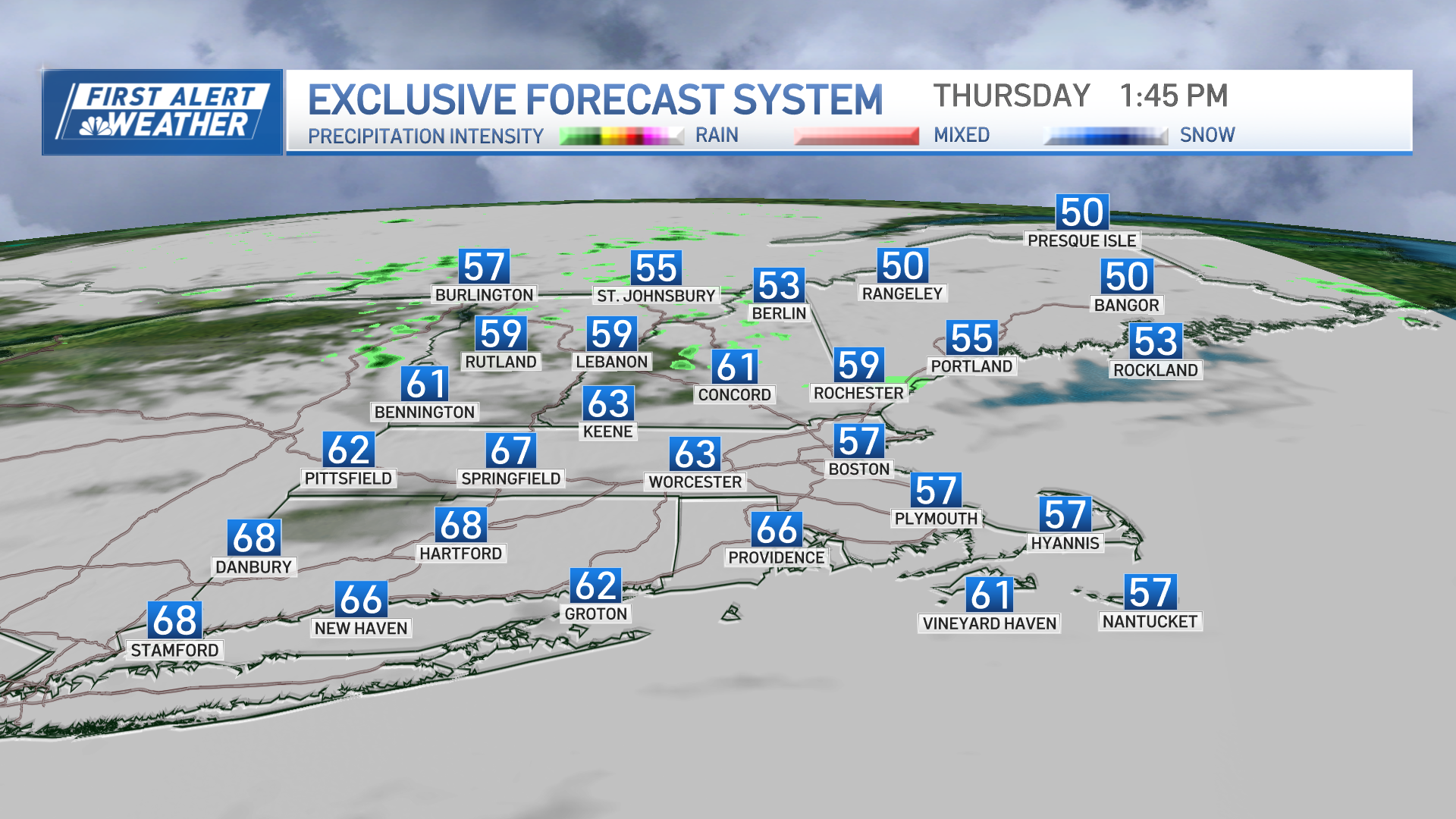
Other than the risk for some afternoon showers across the northland Thursday, the rest of the work week stays on the dry and seasonable side. By the weekend, a system approaching from the west will likely bring more rain and wind to New England as it redevelops off the southern New England coastline. Still some details to work out on this portion of the forecast, but nevertheless, be prepared for another wet weekend.
Have a great day!
