
Exceptionally dry air in New England Monday means plenty of sunshine, punctuated only by a collection of wispy, cirrus clouds during the afternoon as moisture begins to increase aloft.
The abundance of dry air means not only a dry start to the workweek, but also a sneaky dehydration for the body — absent of the usual summer hallmarks of sweating and losing water from the body, the dry air today leads to water evaporating from the skin, making a water bottle important to stave off dull headaches and leaving many grabbing for the skin moisturizer by day’s end.
The dry air also leads to high brush fire danger, particularly during the afternoon, when what began as a quiet wind increases from the southeast, then south in the second half of the day, gusting to 35 mph by day’s end.
Get Boston local news, weather forecasts, lifestyle and entertainment stories to your inbox. Sign up for NBC Boston’s newsletters.
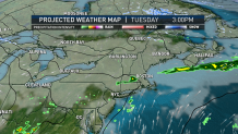
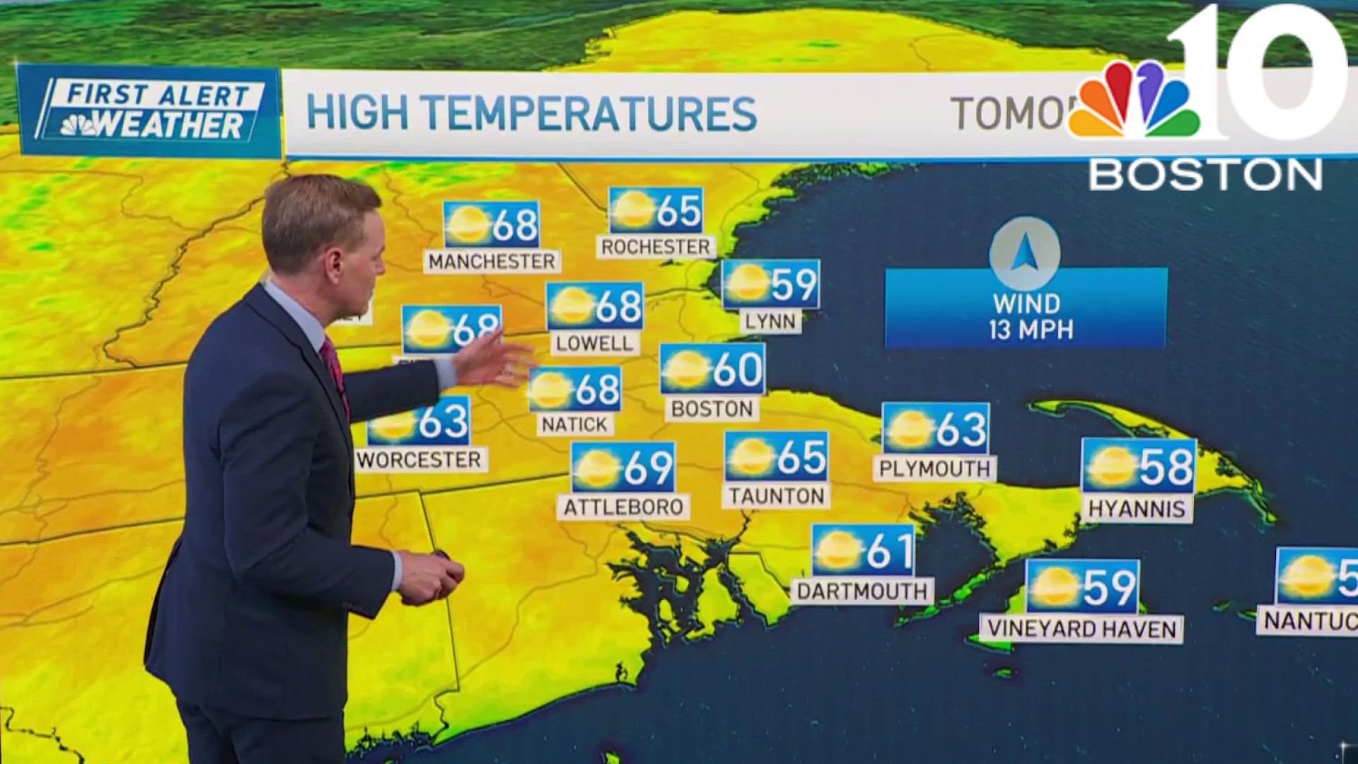
An upper level disturbance and its associated surface cold front slowly drop south Monday overnight and Tuesday, leading to increasing moisture and a few showers from time to time, though most of Tuesday isn’t expected to be raining — just passing sprinkles and light showers at times. With the cooler air behind that cold front in place Wednesday, along with a northeast wind, expect high temperatures stuck in the 40s for many with occasional showers.
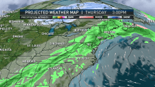
A strengthening southerly wind Thursday should provide one day of deeper warmth — highs reaching well into the 60s and perhaps challenging 70 if we see breaks of sun. However, a few showers are expected in the morning and a round of afternoon and evening showers and thunder are likely as a new cold front delivers a fresh shot of dry, pleasant but cooler air for Good Friday through Easter Sunday.
Weather

The holiday forecast has improved greatly over the last few days, as a large dome of high pressure now appears fast enough to arrive for the weekend before renewed showers arrive early next week in our exclusive First Alert 10-day forecast.
