
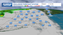
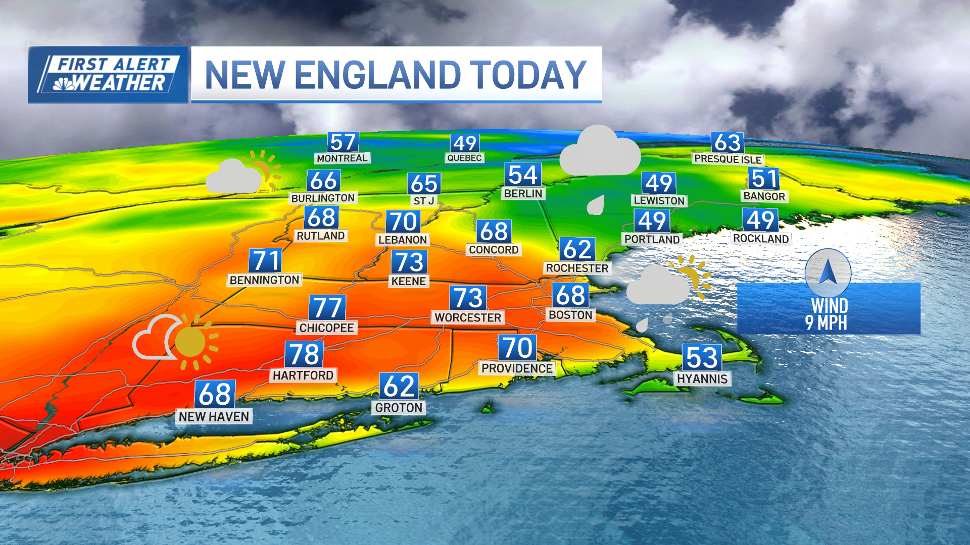
We have a break from rain Friday, as temperatures reach in the 50s for most as the wind will be more from the southeast.
A cold front approaches Friday night and moves through Saturday afternoon. The first few showers move into Vermont for the evening commute. Then, a sneaky shower passes through Boston after 7 p.m. More rain and downpours spread in from west to east along the cold front after midnight through Saturday morning.
The rain will bring us around a quarter inch of rainfall. By afternoon, western New England breaks out some sun with a gusty west wind. That downsloping wind, combined with late day sun will allow our temps to reach the 60s.
Get Boston local news, weather forecasts, lifestyle and entertainment stories to your inbox. Sign up for NBC Boston’s newsletters.
Showers linger across southeastern New England through mid-afternoon, and that means Cape Cod and the Islands may be stuck under lingering showers and clouds all day.
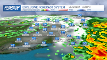
Another wave in the atmosphere and some daytime heating with a cool pool of air aloft moving in, will trigger some late day pop up showers inland Saturday, through sunset.
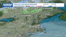
Sunday marks the start of another dry spell. Temps cool a few degrees even with lots of sunshine expected. Cooler air aloft means we see highs around 60 degrees. A beautiful end to the weekend and a great day for gardening.
Both days this weekend, watch for increased wildfire danger as we see humidity levels dropping and some gusty winds.
Weather
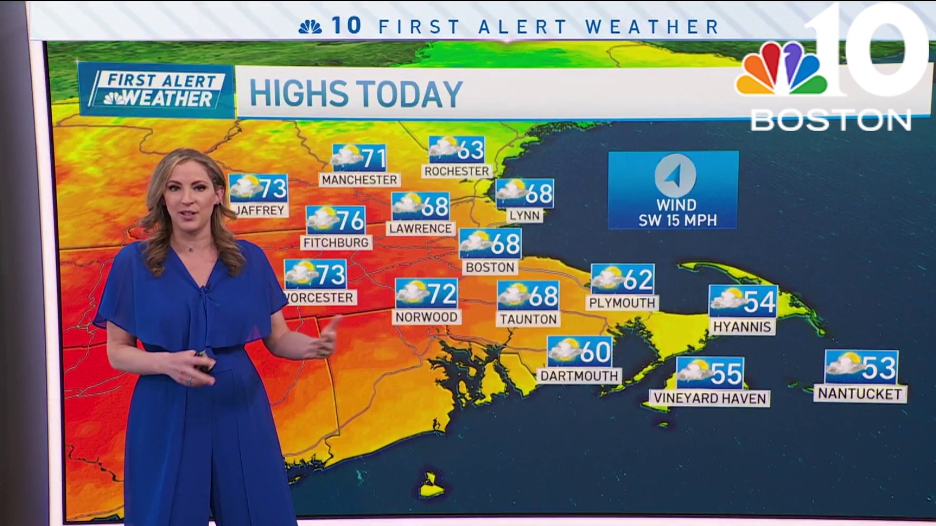
Our dry weather continues through Monday and Tuesday with highs in the low 60s. Our next chance for rain will be on Wednesday, then it seems like another dry stretch returns for the end of the week and perhaps lasting to the next weekend.
