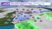
There's not much going on Wednesday afternoon across southern New England, except for a few passing flurries as low pressure well south of New England develops. Overall, southern areas will be above freezing this afternoon, so anything that falls will be melting, for the most part, on contact with the ground.
It is not until Wednesday evening and night when we expect to see the snow shower activity kick up a couple notches. With that said, it will be short lived, as much of the precipitation should be pulling away from the area around or just after midnight.
STAY IN THE KNOW
Watch NBC10 Boston news for free, 24/7, wherever you are. |
|
Get Boston local news, weather forecasts, lifestyle and entertainment stories to your inbox. Sign up for NBC Boston’s newsletters. |
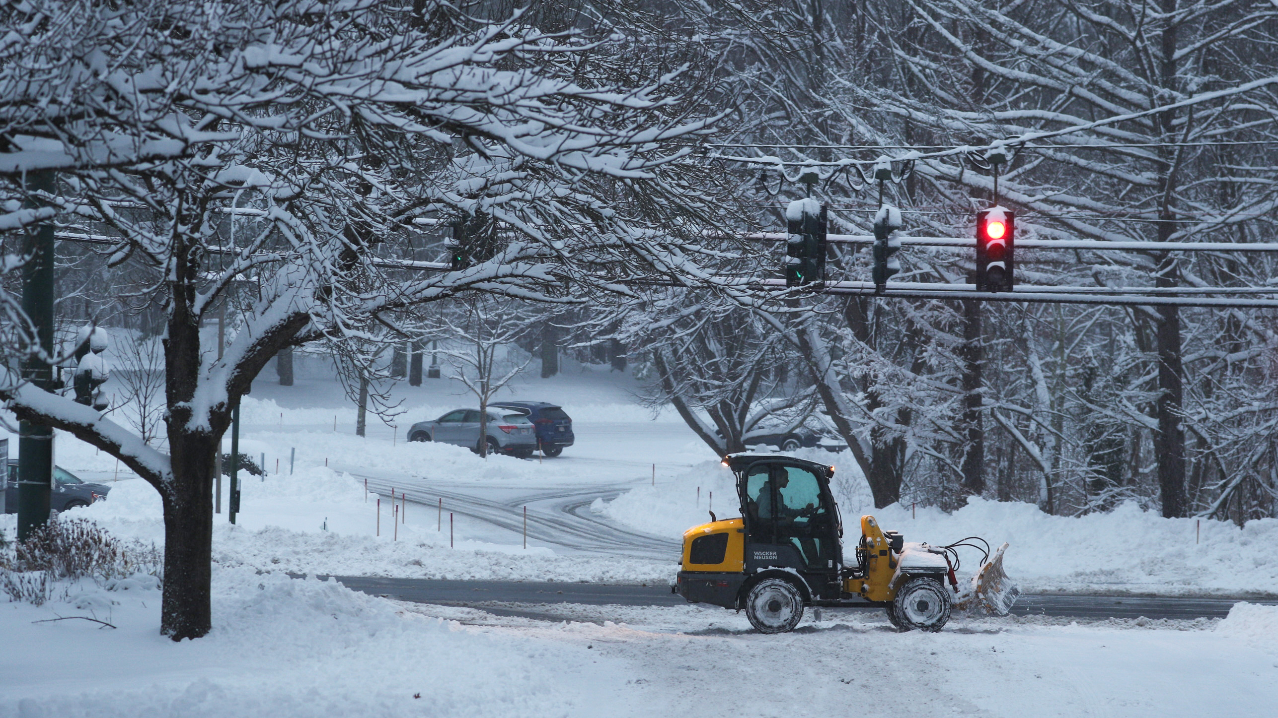
A coating to an inch or so is expected for much of the area except along the immediate coast and in the southeast. The main concern will be wet roadways freezing up, especially the secondary, untreated roads after sunset Wednesday evening.
329 medal events. 32 sports. Endless drama. Catch all the action at the Paris Olympics. Sign up for our free Olympics Headlines newsletter.
Take it slow overnight and into Thursday morning. Northern areas, especially coastal Maine from the Portland area northward, will see a bit more in the way of snow -- several inches is expected.
We’re also watching to see if the Norlun trough, just offshore, enhances the accumulation totals.
Temperatures on Wednesday afternoon will be in the mid to upper 30s south, upper 20s to around freezing north.
Thursday will feature cool temperatures with a gusty breeze out of the northwest at times. Highs around 40 south, 30s north.
A warm front pushes through the region late Thursday night and may trigger a few rain/snow showers, but doesn’t look like a big deal. Lows Thursday night in the 30s south, 20s north.
After a cool day Friday, showers will arrive Friday night and continue into the day Saturday; we’ll also be dealing with a gusty southerly wind. The trade-off will be milder temperatures!
Highs Saturday will reach the low 60s across much of southern New England, 50s northern areas. A cold front passes through the region Saturday night, bringing more gusty winds and perhaps a couple thunderstorms.
It will be drier on Sunday with temperatures in the 40s. And next week is looking mild and somewhat quiet!
Stay safe out there!