A pretty Sunday afternoon with seasonable temperatures and not too much wind.
Upslope snow is finally letting up in the mountains of Vermont, where 2 to 6 inches of snow fell in the last 36 hours, a great recovery since our warm wet Christmas Day for ski areas in western New England.
High pressure south of New England moves offshore tomorrow with a return flow bringing relatively mild air back into southern New England. Low pressure will track to our north with a warm front going overhead, that’ll bring the clouds back in overnight.
Temperatures will cool rapidly this evening with a big bright 'Cold Moon' in the southeastern sky. To its right you can find the planet Mars, and further to the right and down- you can still see Jupiter and Saturn close together. Temperatures will bottom out 15 to 25° the first part of the night before warming a bit toward sunrise as clouds increase.
We end up mostly cloudy tomorrow with the few raindrops in southern New England, and a couple of rain or snow showers in the higher elevations north. Most of the day is dry, though, with temperatures in the 30s north and 40s to 50° south.
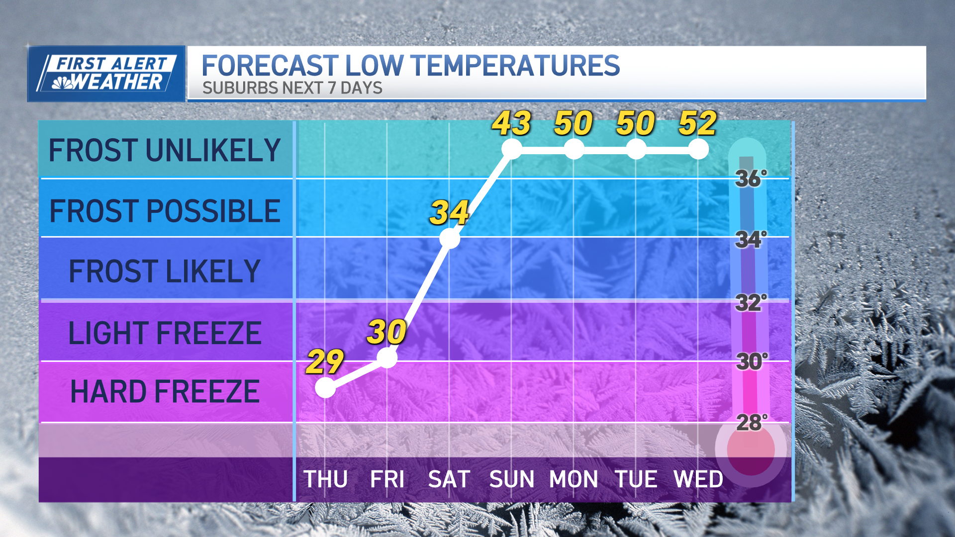
A sharp cold front goes by tomorrow night with a few rain or snow showers early Tuesday, followed by some of the coldest dry air so far this season with temperatures in the teens north and 20s to low 30s south as sunshine returns with a brisk breeze from the northwest.
Wind will let up on Wednesday with temperatures going back to seasonable levels in the 30s with plenty of sunshine in the morning, increasing clouds in the afternoon.
Weather Stories
The New Year’s Eve forecast has improved a little bit -- it looks like just a little bit of light rain late in the day with temperatures getting well to the 40s. A big change in the forecast since yesterday is for colder air to come in as we countdown to 2021. New Year’s Day Friday looks very different now with our wind from the north and a chance of a wintry mix. Such a dramatic change in the forecast means that it may change again; it's very low confidence. But there’s a chance we end up with a wintry type storm here the first couple days of 2021, stay tuned to the latest in our First Alert 10-Day Forecast.


