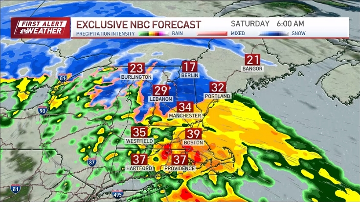
A very complex storm is upon us delivering a mixed bag of precipitation to the region. Similar to what we see early or late in the winter season, there will be a wide range in snowfall totals from the coast to the higher elevations inland.
The storm’s track isn’t the issue, ordinarily we’d expect to see a widespread snowfall with the track it will be taking…the issue is lack of cold air over New England to support that. With temperatures in the mid 30s across much of southern New England, it’ll be hard pressed to see accumulating snow, with the exception inland and across the higher elevations.
See all the active weather alerts here and school closings, delays for Monday here

Get Boston local news, weather forecasts, lifestyle and entertainment stories to your inbox. Sign up for NBC Boston’s newsletters.
Expect to see a mix of rain and snow along the coast, mostly snow inland and into central New England this afternoon as low pressure moves off the mid-Atlantic coastline. Yes we’ll see a few bursts of snow closer to the coast as the precipitation gets heavier, helping to draw down colder air aloft, but getting that snow to stick will be an issue, perhaps a bit on the non-asphalt surfaces.
Low pressure will intensify south of New England overnight tonight allowing slightly colder air to get involved, which will help change mixed precipitation to all snow through the overnight hours, this is when the coast will see its accumulating snow.
Follow the storm on our interactive radar:
This will likely affect the Monday morning commute, expect to see some delays and school closings. Snow will come to an end during the morning inland, but hold on a bit through the afternoon across eastern Mass and the Cape where we could see a few moderate to heavy bursts.
The jackpot for snow will be across the higher elevations of Worcester County into New Hampshire, as well as the Berkshires into the mountains of southern Vermont where we’ll likely see 6-8”+ of snow.

Closer to the coast, we’ll see lesser amounts in the order of 2-3” around the Boston area, keep in mind, a couple degrees plus or minus will be all it takes to make a difference in final snow total amounts, we’ll definitely be keeping a close eye on that!
Winds along the coast will also increase out of the northeast this evening through Monday morning with gusts along the coast around 30 mph, 40 mph across the Cape and Islands. We’ll turn colder Tuesday with highs in the upper 20s, slightly milder by the mid-week and on the quiet side.

Have a great Sunday!