Overnight Tonight: Scattered clouds, chilly. Lows low 30s.
Monday: Some AM sun, increasing PM clouds, cool. Highs mid 40s.
Follow NBC10 Boston on…
Instagram: instagram.com/nbc10boston
TikTok: tiktok.com/@nbc10boston
Facebook: facebook.com/NBC10Boston
X: twitter.com/NBC10Boston
There are big changes coming over the next several days in terms of temperatures and precipitation.
This weekend has been nothing short of a bonus as we find ourselves stuck in the middle of February with record high temperatures yesterday, and high temperatures today running well above average.
WATCH ANYTIME FOR FREE
Stream NBC10 Boston news for free, 24/7, wherever you are. |
Get out there and enjoy it because winter is not done and will make a big return Tuesday as we gear up for a major snowfall across much of southern New England.
Click here to see all the weather alerts across New England.
Get updates on what's happening in Boston to your inbox. Sign up for our News Headlines newsletter.
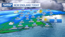
A weak area of high pressure will provide us with mild temperatures today along with clouds and sun. Much of the region will stay dry except for the higher elevations of northern New England where we’ll see some passing flurries and snow showers, not amounting to much.
Highs mostly in the 40s south with a few 50s thrown in, 40s north, 30s across the higher terrain.
Monday will be quiet with clouds on the increase and high temperatures slightly cooler, in the mid 40s south, 30s north.
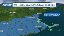
Winter storm watch for southern New England
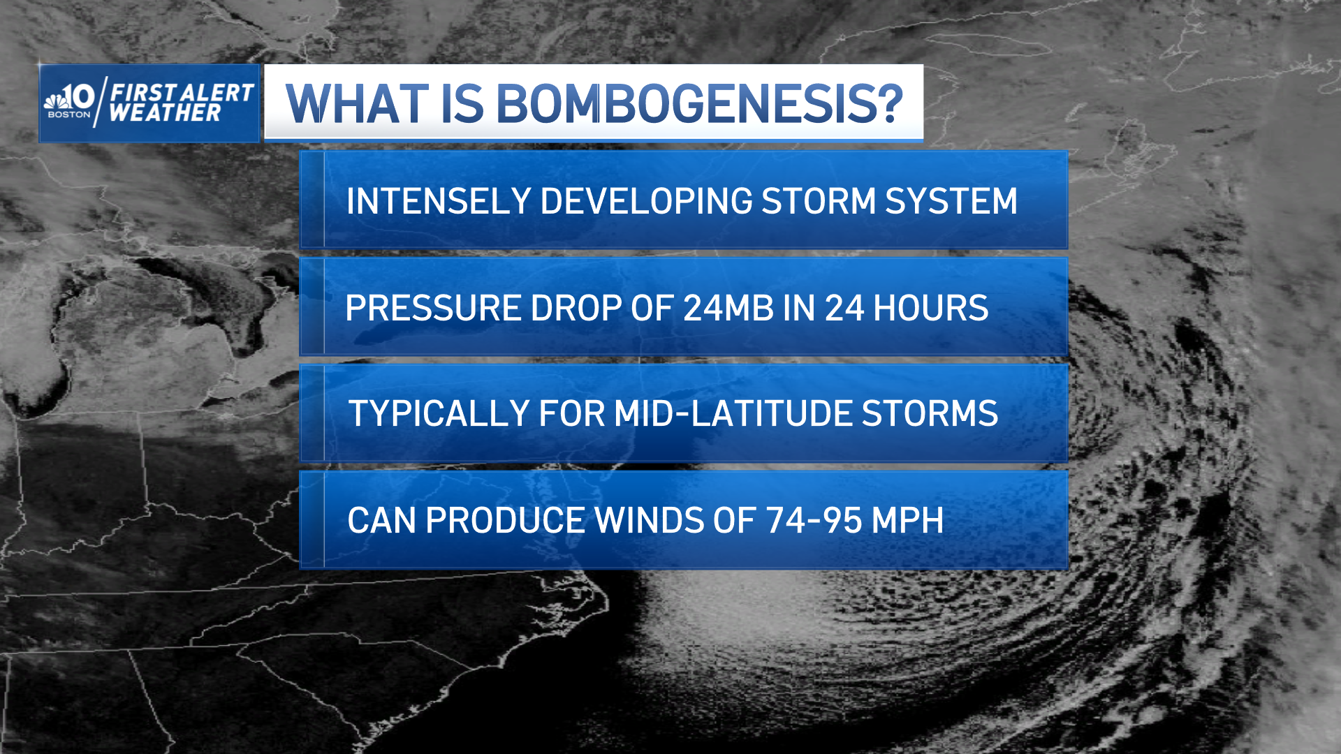
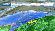
Our attention turns to Monday night and Tuesday as low pressure tracks off the eastern seaboard and rapidly intensifies south of New England a First Alert has been issued Monday night and Tuesday.
Precipitation breaks out from southwest to northeast by midnight, mostly as snow, but along the coastline temperatures will still be mild enough to support rain, but that should quickly turn to snow as colder air aloft mixes down to the surface, it stays rain and mixes with snow after day break in southeastern Massachusetts and the Cape.
As our system rapidly intensifies, snowfall rates may reach 1-3” per hour after daybreak Tuesday through much of the morning before winding down late in the day.
Track the storm with live radar
Temperatures along the coastline Boston points north, will be at or just above freezing which looks to mitigate snow amounts a bit, but latest model trends are indicating colder solutions and more of a northerly wind which help temperature drop to freezing or below, allowing for snow to pile up quicker, still need to watch this area closely in case the storm track changes slightly.
Wind will also be a major concern, especially toward the Cape where a high wind watch is up for wind gusts up to 60mph from the north/northeast. An astronomical high tide will be another factor along the coastline where a coastal flood watch has been issued from Tuesday afternoon until Wednesday, we’ll be monitoring this very closely.
How much snow will Mass., NH get?
Also expecting power outages due to the strong winds and wet snow, especially across the Cape and Islands. As of now it looks like a widespread 6-12” of snow will fall across much of southern New England, lesser amounts into central and northern areas as well as the Cape & Islands where we will see precipitation start off as rain and eventually change to wet snow.
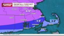
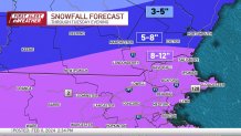
There's still some wiggle room in those numbers and we will updating as new information comes our way, in the meantime, now is a good time to prepare.
Have a great rest of your Sunday!