Two fast-moving weather systems will zip through over the holiday weekend, and while we will be threatened by a few showers, it’s nowhere near washed out.
Friday’s showers are already on their way out. Cloudy debris will remain behind, but in some spots across Central Massachusetts and Southern New Hampshire, we may see a few sunny breaks late day. Temperatures remain on the chilly side – for our recently mild standards – only making it into the upper 40s.
On Saturday, the sun will be out early and will blend with some clouds from time to time. Without any cold air funneling in, we’ll find some towns and cities cozying up to 60, while sea breezes keep the coast in the low/mid 50s. It’s the brightest day of the weekend.
Get Boston local news, weather forecasts, lifestyle and entertainment stories to your inbox. Sign up for NBC Boston’s newsletters.
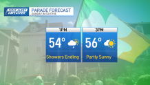
Any showers on Sunday should wrap up in the early afternoon, with sun helping us into the mid/upper 50s by afternoon.
This is the second weather system rolling by, but instead of bypassing the cold, this one will tap into some chilly air on its way out to sea Sunday night. The result will be a much colder start to the work week – accompanied by some more wind into Tuesday (yay). We’ll average below normal through at least midweek before the cold mellows toward the end of the week.
Enjoy the weekend and Happy St. Patrick’s Day!