
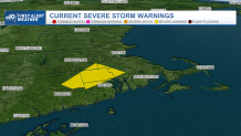
At least two tornadoes touched down in Massachusetts on Friday morning, while radar indicated another twister touched down in Rhode Island, according to the National Weather Service.
In Massachusetts, one or two tornadoes hit North Attleboro and Mansfield, and another tornado was confirmed to have hit Weymouth. Details on the strength of the tornadoes and how far they traveled along the ground was still being confirmed by National Weather Service field crews.
In Rhode Island on Friday morning, a radar-confirmed tornado was reported in Johnston and Scituate, according to the National Weather Service.
The storm also knocked out power to thousands in Rhode Island, Massachusetts and Connecticut.
Get Boston local news, weather forecasts, lifestyle and entertainment stories to your inbox. Sign up for NBC Boston’s newsletters.
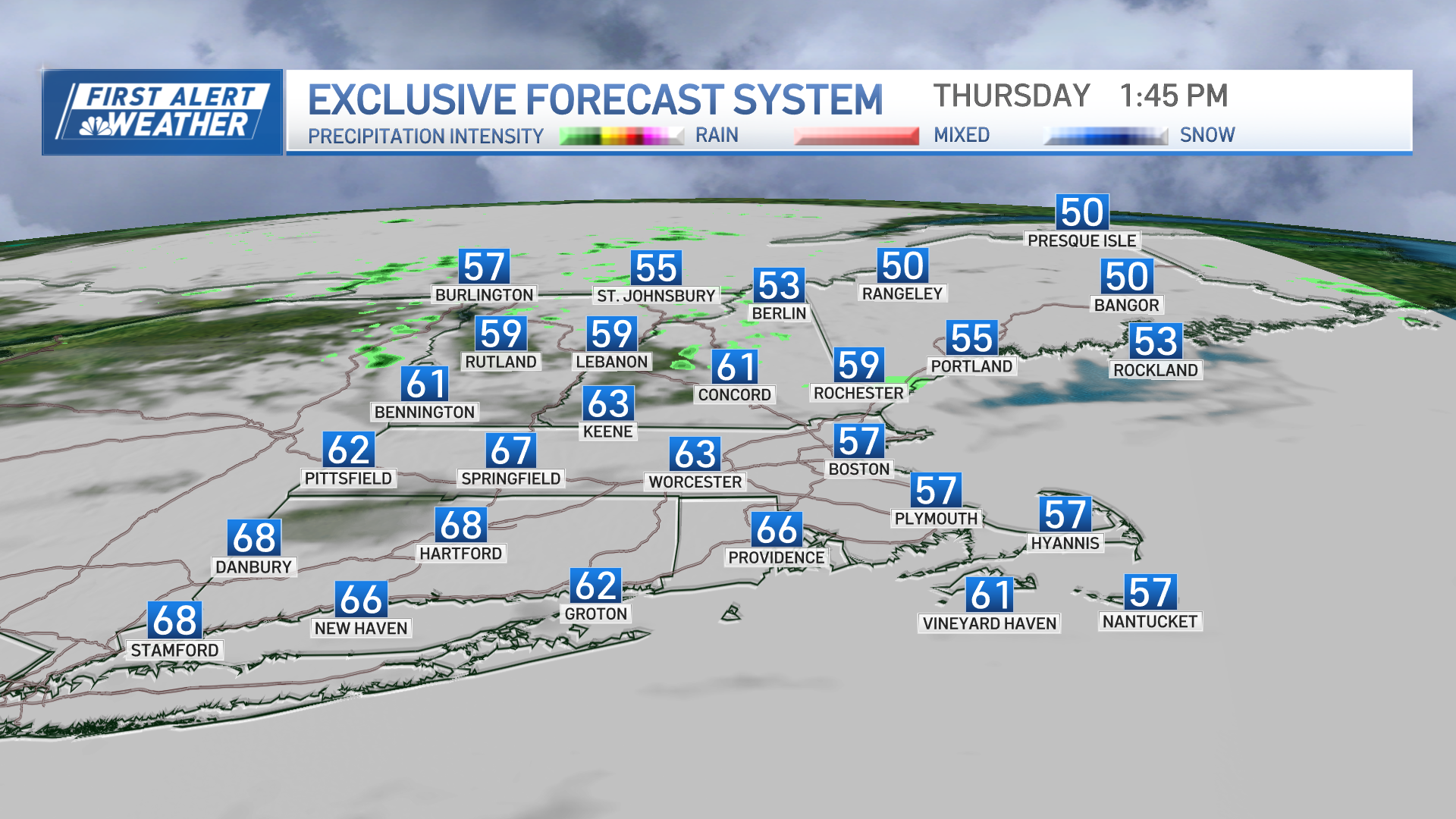
A narrow, but nasty line of thunderstorms oriented from north to south brought downpours throughout central Massachusetts and southeastern New England between 11 a.m. and 3 p.m.
Because of the pace at which the front was moving, the overall flash flood threat was low.
The early show of storms will contain lightning and brief-weak tornadoes.
Weather
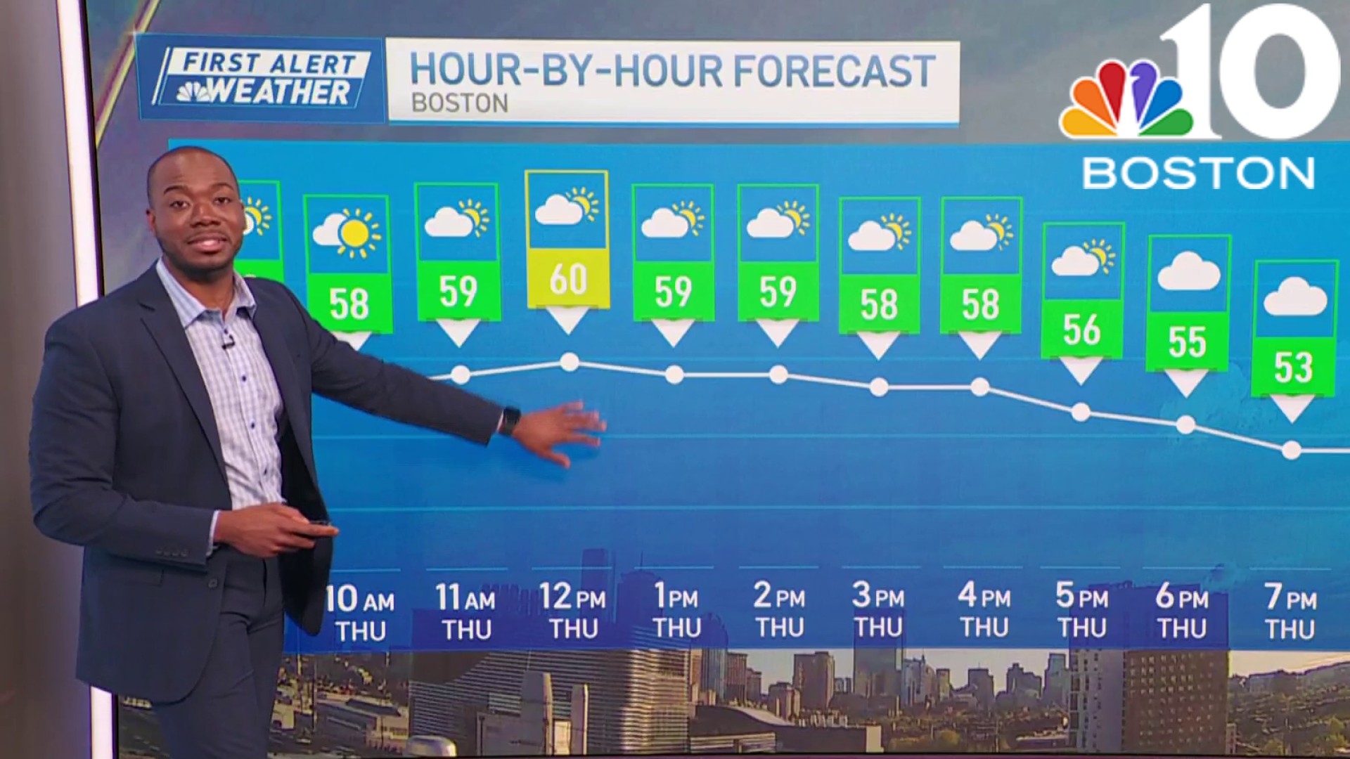
The action should wrap up around sunset, making way for a nice sunset and dry Friday night.
The National Weather Service said that it would attempt to have its crews conduct surveys on damage from Mansfield, Massachusetts to Scituate, Rhode Island on Friday.
The intense weather led to street flooding and downed trees in communities across New England.
Saturday starts cooler, in the upper 50s to low 60s. High temperatures on Saturday are near 74 degrees. Under dry skies Sunday and a west wind, temperatures are expected to rebound into the mid 80s.
