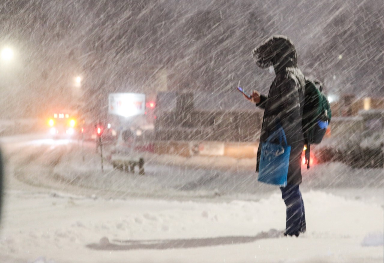
As the nor'easter continues to rage Thursday morning, we're still seeing plenty of sleet as the precipitation du jour.
For the record, sleet is more slippery than snow since flakes readily melt (or more easily manipulated by road treatment) while sleet maintains its integrity longer as solid ice. And since temperatures are near freezing, it's extra slippery (any frozen precipitation is more slippery near or above freezing than well below freezing).

Coastal flooding
Get Boston local news, weather forecasts, lifestyle and entertainment stories to your inbox. Sign up for NBC Boston’s newsletters.
As our storm rolls into the Gulf of Maine, precipitation/wind intensity will ramp down considerably for most the morning. Unfortunately, it hangs on north of Boston through the Merrimack Valley, Cape Ann, and the Seacoast of New Hampshire until early afternoon. It's here we may see some actual snow on top of the slop to finish things off.

The high tide cycle from 7 a.m. to 8 a.m. is most problematic for flooding. The highest risk for local flooding is Revere, Boston and Scituate. Area wide, Edgartown could see moderate flooding. Afternoon tides run high but are not significant enough for minor flooding – and thankfully, the wind will be shifting to the northwest.
Rain lingers after nor'easter exits
We're struggling with the sun in the coming days. Not expecting much at all until Sunday. A quick shower also is possible, but none of the Fri-Sun time period looks like an all-day rain.

Warm weather next week just in time for solar eclipse
Next week is still looking good, especially for the eclipse! We've introduced the prospect of a sea breeze both Tuesday and Wednesday to knock back the temps near the coast. Otherwise, 60s seem to rule.
Safe travels today!