Popup storms are possible in New England Wednesday — a warning was issued for a severe thunderstorm that passed through Vermont at one point in the afternoon.
See more severe weather warnings here.
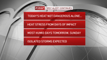
As our New England heat wave continues unfolding and still looks to be a six-day stretch of 90 degree plus daytime high temperatures for some communities, there are subtleties in the forecast each day that will prove impactful.
Wednesday’s wind is lighter than Tuesday, which means we may see a weak afternoon sea breeze developing and for this reason the immediate coast, including the City of Boston, may fall a degree or two shy of Tuesday’s highs in the middle 90s, but still should surpass 90 degrees before the sea breeze kicks in. Humidity is elevated but not outrageous with dew point temperatures in the middle 60s, though that will change Thursday as humidity increases on a southerly wind.
Get Boston local news, weather forecasts, lifestyle and entertainment stories to your inbox. Sign up for NBC Boston’s newsletters.
In the interim, New England’s sky will remain mostly sunny, but that doesn’t mean storm-free. One thunderstorm rumbled through Western Massachusetts early Wednesday morning after developing Tuesday night over Lake Ontario near the Canadian border. There simply was no reason for it to weaken given the ample warmth and moderate humidity.
Similarly, while storms Wednesday will be isolated, anything that does develop will do so in a hot air with cooler air aloft, which is a great recipe for a storm to strengthen, so the phrase "when thunder roars, go indoors" applies with New Englanders encouraged to keep an eye to the western and northwestern sky.
Thursday’s thunderstorm chance appears mostly focused in the afternoon and evening for northern/western New England and central/southern New England, respectively, as a weak cold front crosses New England and triggers those storms.
The increased humidity Thursday would aid in making any of those storms capable of packing a punch with wind and hail, in addition to lightning, but outside of any storms the humidity’s widespread impact will be to drive up the heat index, making highs in the 90s feel like either side of 100 degrees. Although most of this hot stretch doesn’t qualify as dangerous, Thursday afternoon’s heat will, making hydration and breaks to avoid overexertion important.
Get updates on what's happening in Boston to your inbox. Sign up for our News Headlines newsletter.
Humidity is expected to lower noticeably Friday for all but the South Coast, but it won’t be dry enough to squash an isolated thunderstorm chance, which still will exist through the day, with a similar day expected Saturday before humidity spikes again Sunday and another round of more organized storms are possible late in the day.
Interestingly, even with this extended heat, our First Alert Team is not predicting any record high temperatures at this point – this week of July historically is our warmest week of the year, on average, and that means we’ve seen some hot July days, with records ranging from 99 to 103 degrees depending on the day. One possible warm record that may be set would be Friday or Saturday overnight low temperature, but that’s not a lock, and if our forecast high temperature continues to climb for Sunday or Monday, currently predicted to be 94 degrees and 89 degrees respectively, we’d push close to the records of 98 degrees (from 1933) and 96 degrees (from 1882), respectively.
While the deepest of the heat should break heading into next week, our First Alert 10-day forecast still shows temperatures of 85 to 90 degrees most of the week!