Winter storm warnings were issued for parts of Massachusetts, New Hampshire, Vermont and Maine ahead of what's expected to be a powerful nor'easter that will bring rain, wind and potentially lots of snow to New England this weekend.
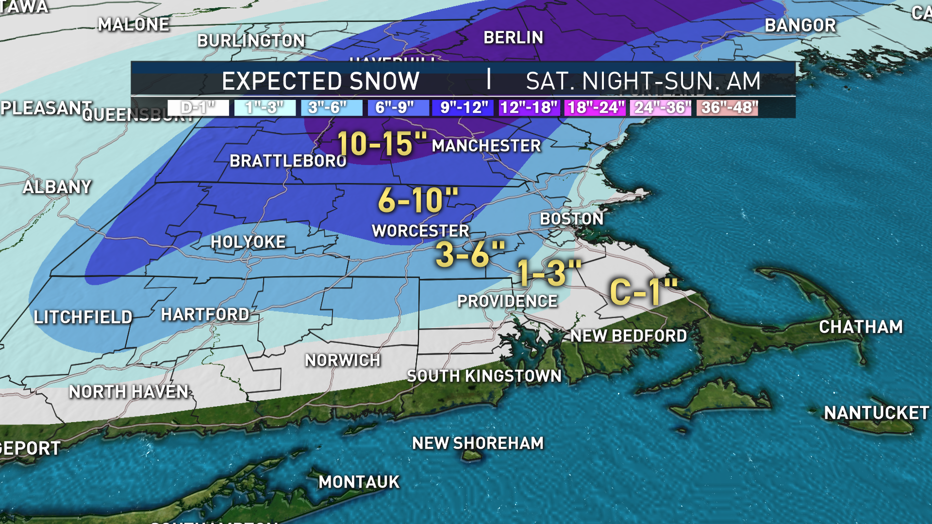
NBC10’s First Alert Weather Team is forecasting heavy rain followed by snow that could reach over a foot in some areas, all compounded by high winds that can cause road conditions to deteriorate.
The National Weather Service's warnings are in place for much of Massachusetts, New Hampshire, Vermont and Maine. The warnings vary in length but generally stretch from Saturday morning to Sunday afternoon and refer to expected snow totals of at least 6 inches, and in some cases over a foot. See all active weather alerts in our area here.
TIMELINE: An Hour-by-Hour Look at This Weekend's Nor'easter
The storm is coming together to our south, with rain turning to snow along with wind in the forecast Saturday, and into Sunday in Maine.
In the short-term, raindrops, not snowflakes, are in the forecast Friday evening and overnight, slowly expanding through Southern New England by Saturday morning.
There are sources of uncertainty in the forecast, including the delicate merger of a northern and southern disturbance very close to New England that needs to happen just right for a big event in southern New England (but it looks like it should, and almost certainly will for Maine).
The marginal temperatures for snow start in the 40s and then drop through the 30s from midday to afternoon in central and eastern New England as the storm strengthens and pulls cooler air from northern and western New England.
As long as the storm comes together as we’re thinking, the rain itself will be impactful Saturday morning, with over an inch falling through Saturday morning for big puddles and ponding of water on roadways.
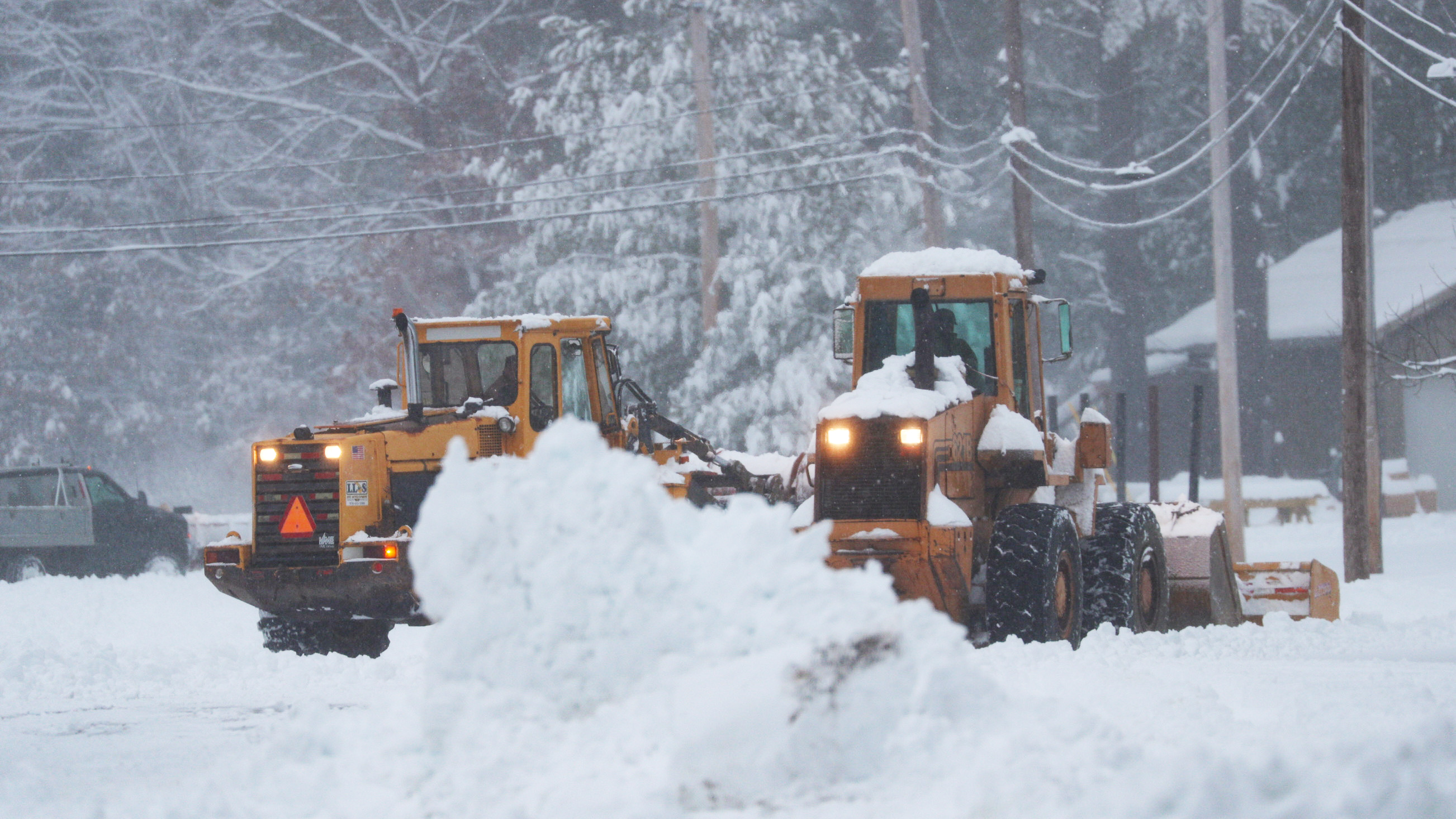
Of course, as rain changes to snow in the high terrain of central Massachusetts and across much of northern and western New England, roads will deteriorate, with standing water pounded by wet snow causing slush and icing on roads. Add snow accumulation on top of that and it will likely require plowing and treatment.
Farther east, the concern is not as long in hours, but may be intense for a short time Saturday afternoon. As the storm strengthens quickly in the east, a burst of heavy precipitation Saturday afternoon on the west side of the storm will move directly over eastern New England, sure to dump extremely heavy snow on much of Maine and eastern New Hampshire, and likely to produce at least a burst of a few hours of heavy snow Saturday mid-afternoon to evening in eastern Massachusetts (though not southeast Massachusetts), which would also cause road conditions to deteriorate quickly.
If all comes together just right, that burst of snow will drop two to four inches per hour of snow from northeast Massachusetts all the way into Maine Saturday evening -- and if were to come together sooner, that potential would extend to the South Shore.
That’s why, even though our First Alert Team is acknowledging some uncertainty and the need to follow our updates, we’ve also been encouraging all residents as far south as the South Shore to put in the driveway stakes, prep the snowblower and plow and be ready for tough travel and road treatments. That way if the burst of snow makes it south through Plymouth County, all will be prepared.
Winds will howl at the coast Saturday afternoon and evening, first gusting to 60 mph out of the south on Cape Cod if the storm center moves directly over the Cape, then swinging to blow from the north and northwest, gusting to 60 mph briefly at Cape Ann and gusting over 45 mph for many others.
The wind could prompt some power outages where the heavy snow falls and puts extra strain on power lines.
More on Saturday's Nor'easter
The storm departs Saturday night, leaving a blustery but dry day Sunday except for lingering pockets of snow and snow showers in the North Country, where over a foot of snow will fall in Maine and New Hampshire.
They'll get a natural boost to start the ski and snowmobile season while Vermont will see lighter snow amounts, but everyone is in for a chilly week next week, perfect for ski areas to blast snow guns and continue building on nature’s snow base, opening trails up quickly in the week ahead.


