
An energetic disturbance moving through our New England sky doesn’t have much moisture to work with, but it’s strong enough to crank out at least some snow showers from west to east over the course of the day.
Where temperatures are coldest -- in northern and western New England -- snow is able to stick a bit more effectively. Accumulations of a coating to an inch are expected in at least the higher terrain of the western part of our region. Meanwhile, 1-to-3-inches of snow is possible between Monday and Monday night in northern New England.
Elsewhere, temperatures above the melting point will combine with light snow shower intensity to limit amounts to a scattered dusting to coating with little impact. The temperatures are mild enough for more raindrops than snowflakes on Cape Cod.
Perhaps the biggest impact will come overnight Monday, when temperatures drop into the 20s under a clearing sky. Areas of black ice will develop where moisture lingers on the roadways.
Tuesday looks quiet as we face a break between disturbances ahead of the next disturbance. It will drive quickly from Idaho Monday to Massachusetts Tuesday night, arriving after the evening commute. The storm will strengthen with the introduction of ocean moisture but will be too late in the game for a significant event.
Instead, a shot of snow (or rain to snow on Cape Cod) will deliver a coating to an inch in eastern and far southern New England, with 1-to-2-inches possible in southern Plymouth and Bristol Counties in Massachusetts.
Farther north, some snow showers are possible Tuesday night with a separate passing disturbance aloft. A brisk wind kicks up and carries cool air with it Wednesday, but dry air will allow for a fair sky with wind chill values in the 20s after some morning snow showers depart northern New England.
Weather Stories
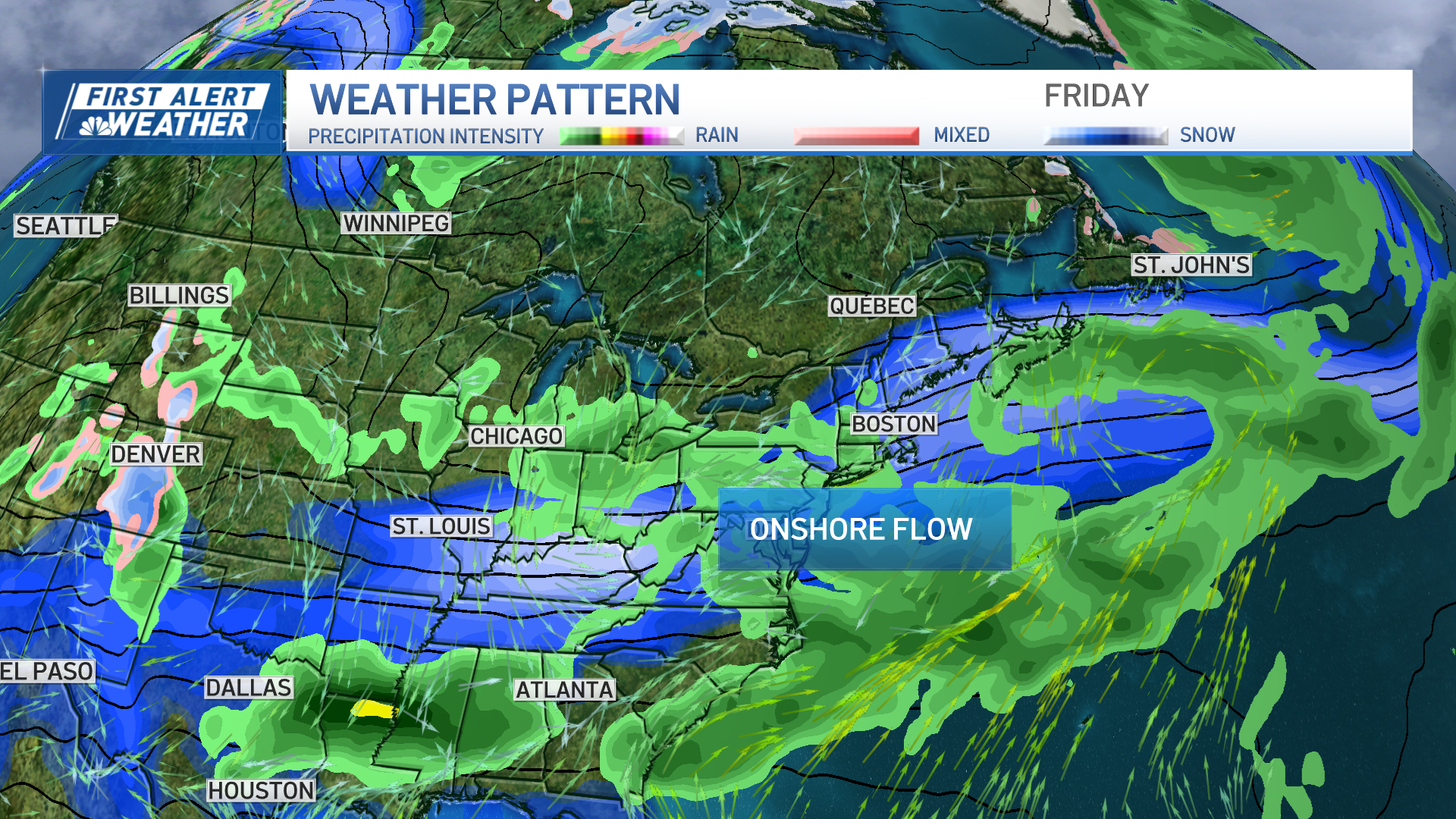
Cold air reaches its peak on Thursday with highs only around 30, even under sunshine. With the next storm strengthening to our west and moving over northern New England Friday into the weekend, warmer air quickly rebounds for the region on Friday.
Late rain showers will arrive then with perhaps a mix north and will continue Saturday when highs reach the 50s with widespread showers and rain.
Our First Alert Team is hopeful for drying after early morning showers Sunday before another storm early next week likely brings more rain, again with a possible mix to start in northern New England.
