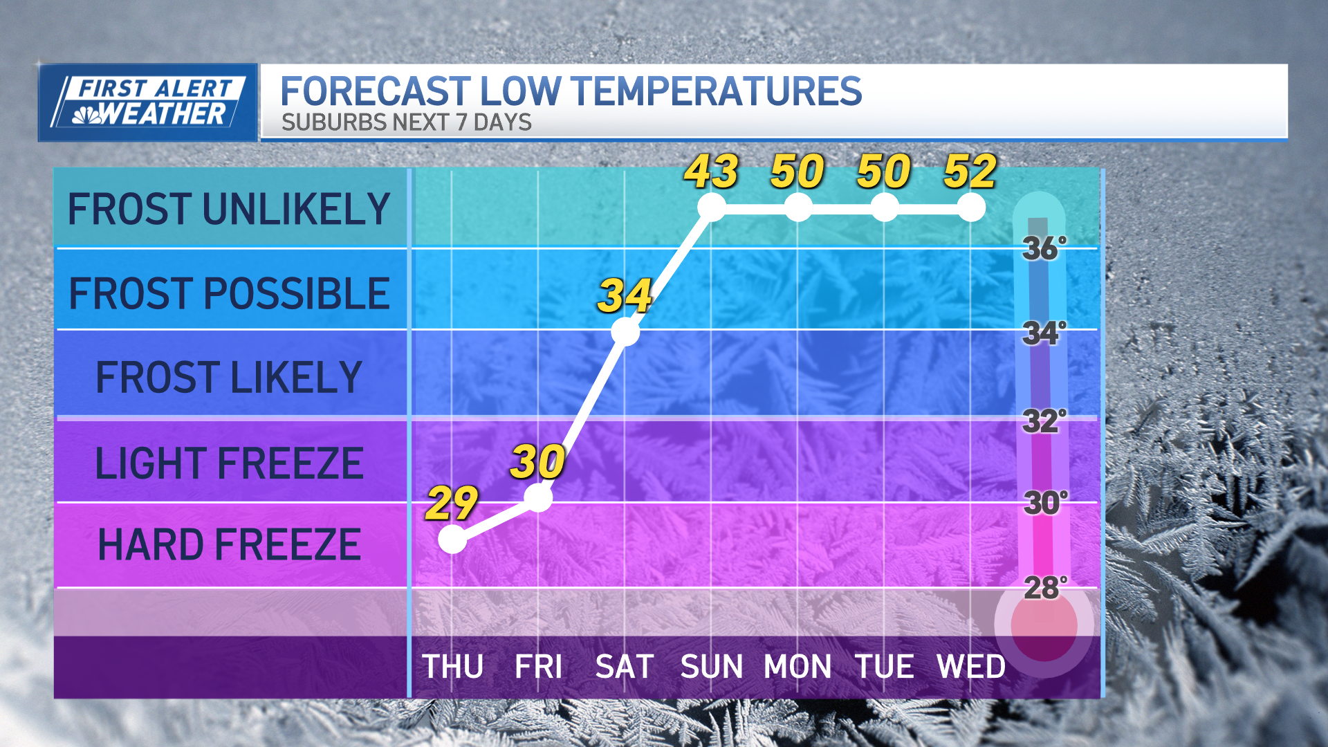
Our advice to New Englanders (and our own meteorology team!): Enjoy the relatively quiet weather this weekend, things could change dramatically next week.
We are expecting some snow showers Sunday morning, but these aren’t expected to be a big deal… though they do indicate the start of a new weather pattern that brings multiple potential storms next week.
In the immediate-term, we focus on the chilly air squarely in place across New England to start the weekend, dry enough to preclude many snowflakes with an incoming disturbance Friday afternoon that will deliver increasing and thickening clouds, but no more precipitation than an evening mountain flurry in Vermont.
The light but tangible morning breeze that drove wind chill values below zero early Friday eases even more later in the day, and remains light through the weekend with little change in air expected.
With dry air remaining in place through Saturday, clouds are expected to build Saturday but the only flurries will be on outer Cape Cod. As the jet stream winds aloft – the fast river of air, high in the sky, that steers storm systems – slowly migrate north, the storm track this weekend into next week starts shifting north with it.
The first disturbance in what will be a long series arrives predawn Sunday with snow showers from west to east, lasting through the morning before sagging southeast over Cape Cod and mixing with raindrops by midday before changing to very light rain showers on the Cape during the afternoon. Snow accumulation for most of us Sunday morning looks to be a coating to an inch, with the best chance of a solid inch or perhaps slightly more being in the higher terrain of western New England and Southwest New Hampshire.
Weather Stories
Get Boston local news, weather forecasts, lifestyle and entertainment stories to your inbox. Sign up for NBC Boston’s newsletters.
Once the weekend is over, our chance of messy weather soars. A disturbance Monday may not be moisture-loaded, but will encounter an onshore wind from the northeast at ground level, raising the chance of either freezing drizzle or some light wintry mix to start the week on Presidents' Day.
A strong, follow-up disturbance Tuesday comes loaded with moisture from the Gulf of Mexico, as a pattern featuring a big jet stream trough – or dip -- in the central U.S. steers disturbances past the Gulf before rounding the bend and sailing north up Interstate 95.
With a storm track that incorporates southern moisture and warmth comes the potential not only for heavy precipitation amounts, but also an increased likelihood of larger areas of mixed precipitation – from snow to sleet, freezing rain and, perhaps for some far enough south and southeast, some rain. We’ve issued a First Alert for Tuesday owing to the impact of this likely heavy wintry mix.
After a one-day break Wednesday, another storm may follow for later Thursday into Friday. Although we’ve issued a First Alert for Thursday, our forecast isn’t calling for this next wintry mix to move in until afternoon or evening, with the bulk of the storm unfolding Friday. Of course, at seven days out, the potential impact of this system is inherently in question, depending on whether the storm forms, where it tracks and what the temperature setup will be.
Regardless, the early call from our team is we should get another break in the action next weekend – a breather on Saturday and Sunday would be nicely timed. Our team will keep you posted on updated details and changes.


