
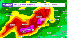
Monday was beyond awful for Leominster, Gardner and Pepperell, as central Massachusetts experienced catastrophic flash flooding.
The glossary of meteorology from the American Meteorological Society defines flash flooding as moderate to intense rainfall over highly saturated or impervious land surfaces, and generally occurring within minutes to several hours of the rainfall event.
Heavy rain leads to rare flash flood emergency
Get Boston local news, weather forecasts, lifestyle and entertainment stories to your inbox. Sign up for NBC Boston’s newsletters.
This flooding was enough to close major thoroughfares, wash away homes from their foundations and cave in roads. It prompted a local state of emergency for the city of Leominster. Between six and nine inches of rain fell in northeastern Worcester County Monday, prompting a rare flash flood emergency from the National Weather Service.
You’ve likely familiar with a flash flood watch and warning. A flash flood watch means you should be prepared. Conditions are favorable for flooding that day. A flash flood warning means the threat is imminent or occurring. At that point, if you’re in a flood prone area, you should get to higher ground immediately.
When this threat is of the highest importance a flash flood emergency is issued. It’s issued for exceedingly rare situations when extremely heavy rain is leading to a severe threat to human life, and catastrophic damage from a flash flood is happening.
Prior to Monday, the last time such a warning was issued for the NWS Boston forecast area 1168 days ago, in late June of 2020.
These events are catastrophic, in part, because of how quickly they can happen. Flash flooding is flooding that begins within 6 hours, and often 3 hours, of the onset of heavy rainfall. The intensity of the rainfall, the location and distribution of rainfall, the land interaction, vegetation and soil density all play a role in how quickly flash flooding will occur.
Why did Leominster get so much rain?
A combination of a stalled out boundary, tropical airmass (high humidity) and pieces of energy rotating over southern New England caused the localized downpours to basically just sit over one area. There was so much moisture in the air the atmosphere pretty much squeezed it all out in a localized spot: think of it like a big, full sponge sitting over us being wrung out.
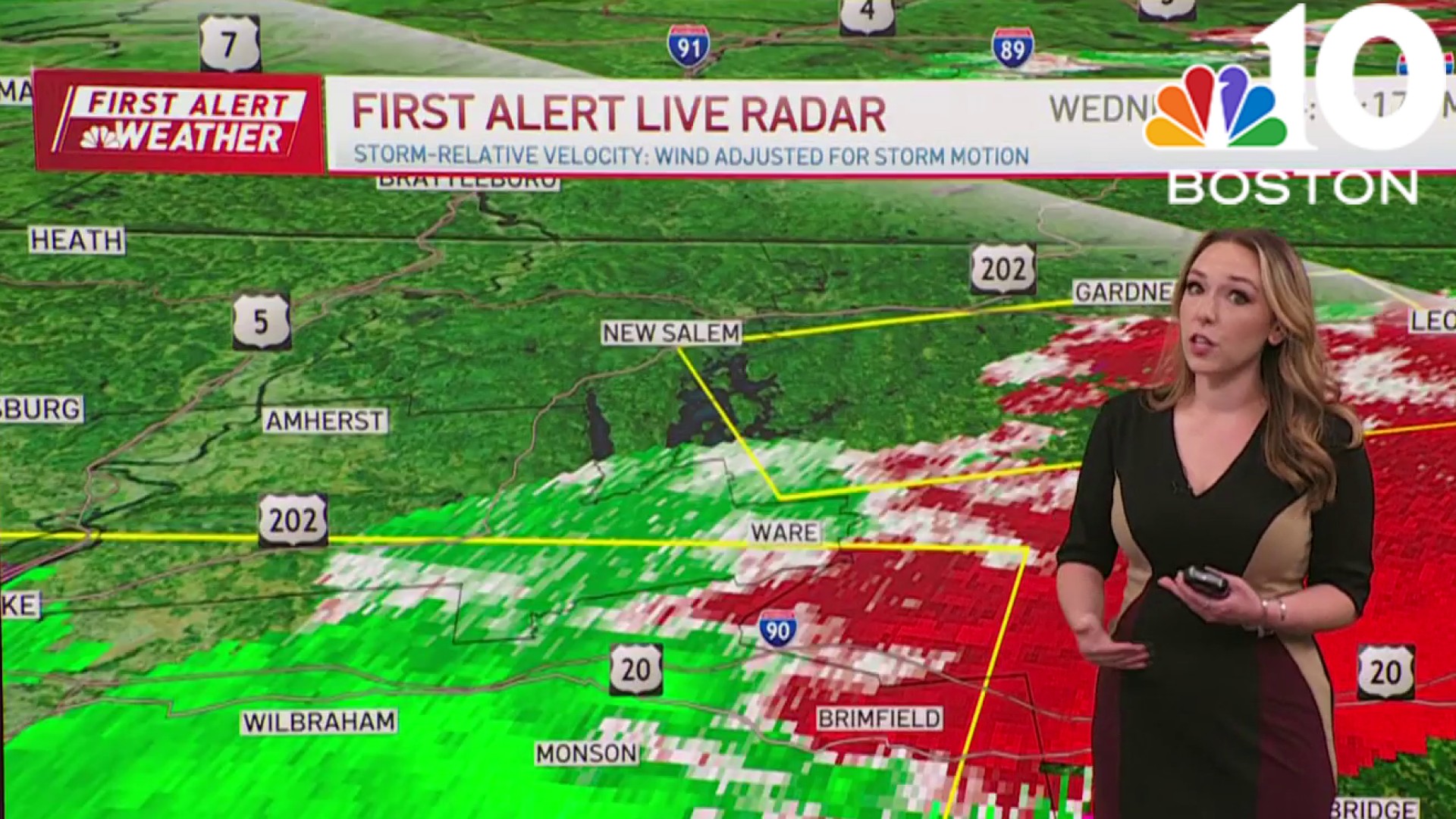
More flooding rain possible Wednesday
While the heavy rain is over for now, and new flooding is not occurring, road washouts and areas of flooding remain. And although Tuesday is a relatively quieter weather day with just some scattered showers here and there, some renewed flooding will be possible Wednesday, as another disturbance approaches the region.
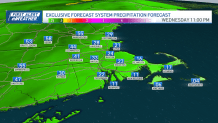
The height of the flood threat will be Wednesday afternoon and evening. Most communities will see rainfall totals under half an inch, but a few localized amounts of around an inch will be possible. An isolated severe thunderstorm is possible as well, so it’s certainly a day to be weather aware. Not everyone will see flooding, but with this record wet stretch and an already saturated ground, it won’t take much for additional flooding to occur.
