
We’re instore for another hot day in New England on Friday. With high pressure overhead, dry air is in place promoting sunny skies. High temperatures warm into the mid-80s again. We don’t anticipate much in the way of cloud coverage, so we’ll feel the full force of the sun today. It’s a very warm day for outdoor graduation ceremonies, proms and Memorial Day weekend events.
Friday night will be a touch cooler, but stays dry…and not as humid either. Temperatures are around 56°.
STAY IN THE KNOW
Watch NBC10 Boston news for free, 24/7, wherever you are. |
|
Get Boston local news, weather forecasts, lifestyle and entertainment stories to your inbox. Sign up for NBC Boston’s newsletters. |


The winds will vary tonight but ultimately change directions tomorrow, out of the east. The day is still dry, but it will be cooler. This sets up a sea breeze and keeps coastal communities in the mid 70s.
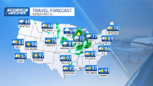
Sunday is similar, but as a weak weather system drops in overhead, there’s a chance of a pop up shower in the afternoon, around 4 p.m.
Heavier rain is likely Monday.
Local
In-depth news coverage of the Greater Boston Area.


The combination of the on-shore wind and clouds will knock down temperatures even more, only in the low 70s. The day will be dry to start, but a shield of rain moves in around sunset. This won’t dampen roads too much until after midnight, when the heaviest and steadiest showers arrive.
Occasionally, a few thunderstorms will spring up, but the current setup seems to support primarily rain.
We’re turning the corner to warmer days too, through the start of June, but not overly hot to start. Seasonable temperatures are expected in the low 70s.
