After all these days of rain, the message has become a little stale. Thankfully, we're focused on terms like drying, brightening and warming in the days ahead.
That said, Friday's a struggle for the last two items. Rain will shut off quickly this morning, but the sun will struggle to take charge of the skies for the reminder of the day. Warming is another matter. 50 is within reach, but just barely
As our storm departs, the wind will pick up later Friday afternoon and overnight.
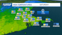
Saturday features a blustery start, with winds easing a bit in the afternoon. This will be the pick of the holiday weekend as highs recover to the low and mid 50s by afternoon.
Get Boston local news, weather forecasts, lifestyle and entertainment stories to your inbox. Sign up for NBC Boston’s newsletters.

A quick-moving weather system will roll in during the night and lay down few early showers for sunrise services and Easter bonnets in the morning. Once again, sun will prevail for the afternoon (mixed with clouds) as highs recover to the low 50s.
Next week continues on a soggy path. A storm arriving Tuesday will develop into a major offshore nor'easter in the Gulf of Maine by Wednesday and early Thursday.
Initially, it's rain but the potential is for snow to emerge as the storm intensifies. Right now, it seems that northern New England has the best chance for significant accumulation, but we'll watch the track and evolution very closely through the holiday weekend.

Either way, the end of the week and the following weekend look good. As does the eclipse on the April 8. We may even be treated to a warming trend by then. Imagine that.
Weather
Have a great weekend!


