We have a First Alert for wind and rain Friday morning across New England.
Scattered wind damage and power outages are possible, with the worst of the wind which is roughly midnight to 7 a.m. Friday. Before we get to that storm, we have near record warmth to track.
Temperatures
Our temperatures continue to rise this morning as warmer air surges in. We have already had some damage reported from the strong wind across Lake Champlain yesterday. That wind is transporting the warmth all the way into Canada. Temperatures continue to slowly rise today until we hit highs in the low 60s south and in the 50s north, with a chance for records to fall. The record for Boston is 61 (1981); Hartford, 64 (1981); Providence, 66 (1981); and Worcester 56 (1981). Our highs on Friday will be just after midnight, as we fall quickly to around 40 degrees in Boston by lunchtime after the rush of wind and rain.
Get Boston local news, weather forecasts, lifestyle and entertainment stories to your inbox. Sign up for NBC Boston’s newsletters.
Wind
Southwest wind gusts will stay strong today, 40-50 mph. Isolated damage is possible, but the main event is overnight and while we sleep, from roughly midnight to 7 a.m. Peak gusts 50-60 mph for Boston, Worcester, coastal New Hampshire and coastal Maine are likely, with higher gusts of 60-70 mph along the South Coast, Cape & Islands. Scattered damage and outages are possible. The wind switches direction quickly Friday morning and by lunchtime we have 30-40 mph gusts from the west-northwest.
Rain
Weather Stories
Scattered rain will be ongoing today across the North Country as a nearly stationary front is draped across the area. A few sprinkles and cloudy skies are found around southern New England. Plenty of dry weather to enjoy the spring-like temps, if you can stand the wind. The showers slowly head southeast, but won’t arrive in Boston until around midnight. This is also when the worst of the wind will be. The showers will be heavy and there may be a rumble of thunder through sunrise Friday as the cold front pushes through. The rain shuts off quickly in Boston after the morning commute. Lingering light snow showers and a wintry mix will hang around Maine and the mountains in northern New England through early afternoon. Around an inch of rain is likely across northern New England, around half an inch for southern New England. With all the rain north, Vermont, New Hampshire and Maine could see some ponding on roads with the rain, along with ice jams and minor river flooding as we have all the snowmelt.
10-Day Forecast
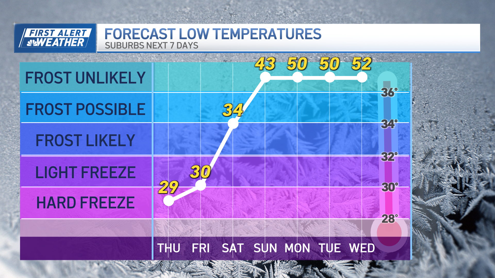
Colder air returns for the weekend, but it won’t be that bad. Highs still reach the 30s both Saturday and Sunday with mostly dry weather both days. A weak low pressure system will bring a quick chance for light snow on Saturday, with a few inches of snow in the far North Country. Next week we have a minor system around Tuesday bringing rain with temperatures warming to around 50 again to start the work week. Another minor storm moves through for Thursday into Friday, as temps cool to seasonable highs in the upper 30s.


