
Monday will bring average temperatures and dry skies, but snow chances are ahead.
Follow NBC10 Boston:
https://instagram.com/nbc10boston
https://tiktok.com/@nbc10boston
https://facebook.com/NBC10Boston
https://twitter.com/NBC10Boston
https://bsky.app/profile/nbcboston.com
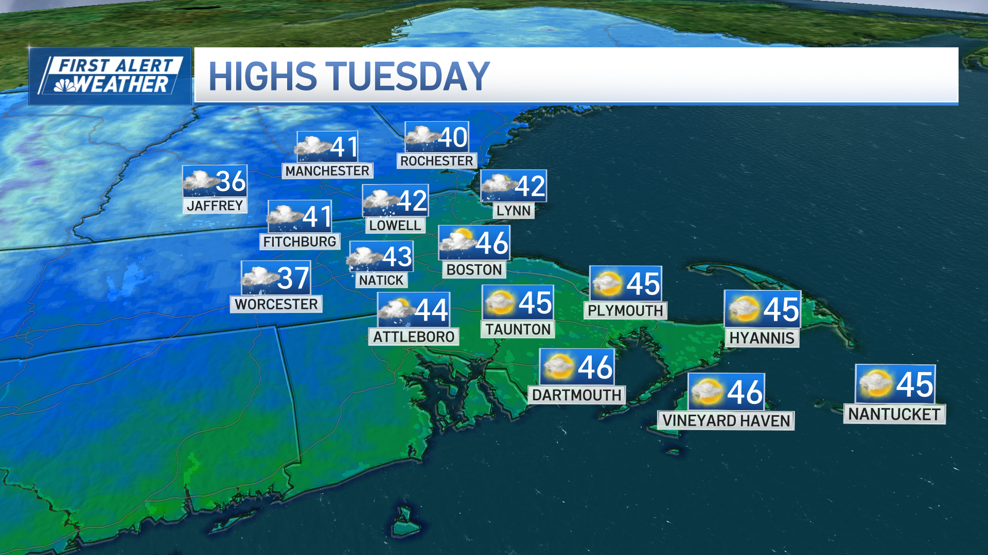
A breezy and mild Monday is in store for southern New England, with winds gusting between 25 and 35 mph, and temperatures reaching the upper 30s to low 40s.
Dry conditions will persist, but a cold front arriving early Tuesday morning will bring another blast of cold by Thursday morning. Expect snow squalls between 4 and 9 a.m.
WATCH ANYTIME FOR FREE
Stream NBC10 Boston news for free, 24/7, wherever you are. |

How much snow are we getting in Massachusetts?
Get updates on what's happening in Boston to your inbox. Sign up for our News Headlines newsletter.
Coverage of snow bursts will not be impressive but those that do see morning snow will see conditions deteriorate quickly, with reduced visibility and slick spots. Winds will also ramp up, with gusts potentially reaching 45 to 50 mph through the early afternoon.
Temperatures will peak early in the day before rapidly dropping into the teens and 20s by the afternoon, making it feel even colder with the strong winds.

Following the cold front, a weak clipper system will bring a chance for light snow on Wednesday, with accumulations generally expected to be minor, two inches or less, with a few higher accumulations in central Mass. High pressure then builds in, bringing dry but colder weather for the latter half of the week, with below-normal temperatures and gusty northwest winds making it feel quite chilly.
Weather Stories

Another winter storm this weekend?
Another system may approach by Sunday, potentially bringing a mix of rain and snow, though the exact details remain uncertain at this time.
Stay tuned for updates as we continue to monitor the forecast.