After a little skim of ice on many of our bird baths this morning, this afternoon is delightful with plenty of sunshine and much less wind. The temperature has recovered from freezing to the lower 60s for many in southern New England, cooler to the north. Variable wind will become south five to 15 mph by late in the day.
That breeze overnight will keep temperatures from cooling as much, with lows in the 40s north and 50s south to start our Saturday. The same strong high-pressure system that brought in our cold weather shifts to the south and returns a flow from the southwest, bringing much warmer air tomorrow.
Get Boston local news, weather forecasts, lifestyle and entertainment stories to your inbox. Sign up for NBC Boston’s newsletters.
High temperatures range from 75 to 80° in southern New England, 60s and 70s north. The next front from Canada wastes no time coming in tomorrow afternoon and tomorrow night. That will bring clouds back with a chance of showers or a thunderstorm in Vermont, New Hampshire and Maine tomorrow afternoon.
It’s a strong low pressure system to our north, creating strong winds from the southwest gusting past 40 mph, with some spotty damage possible. In addition, a few of the thunderstorms may become strong to severe late in the day and around dinner time in central New England.
Much colder air comes in tomorrow night as the front settles south of New England Sunday morning.
With plenty of sunshine on Sunday and a breeze from the north, high temperatures will be in the 50s north, to low 60s south.
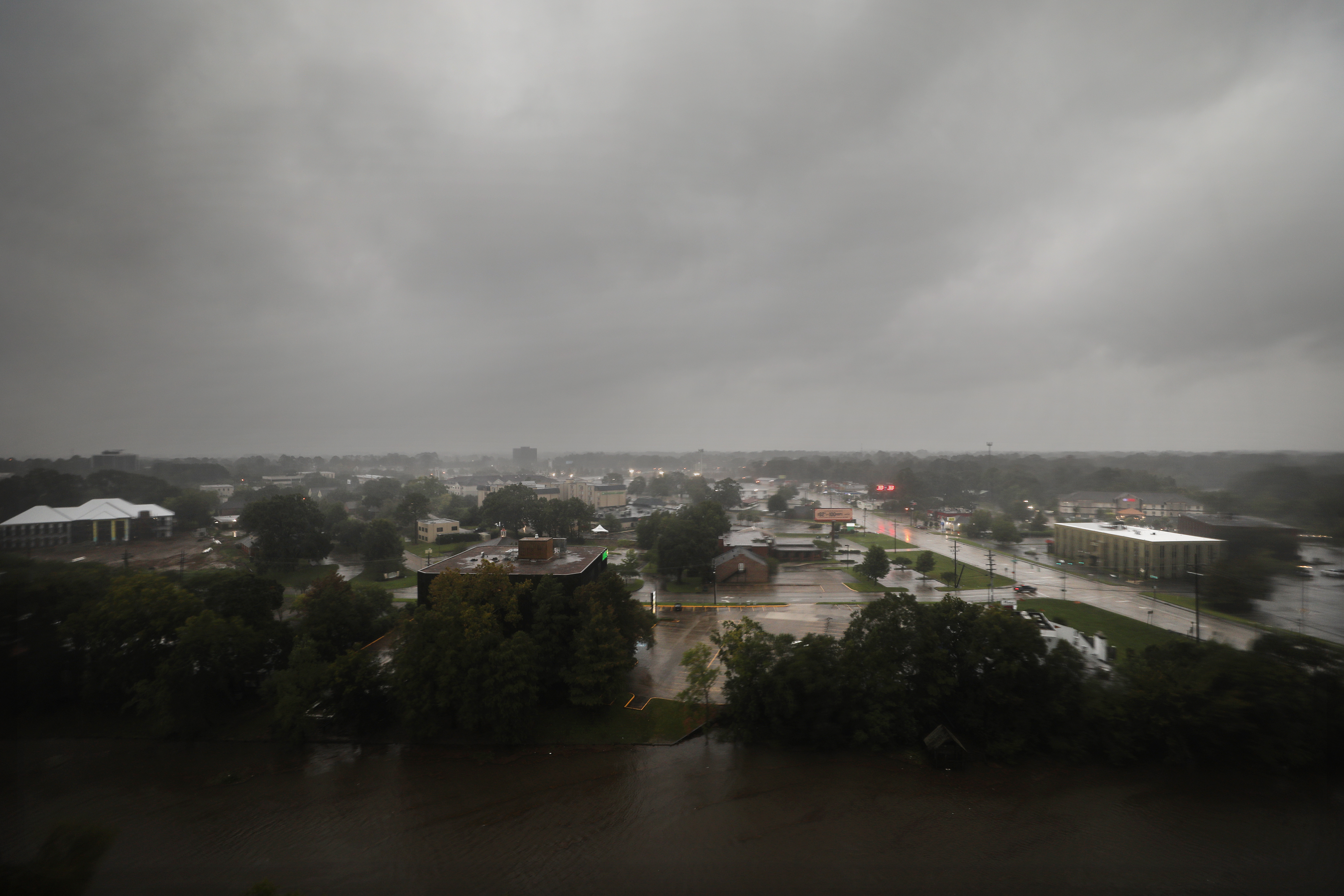
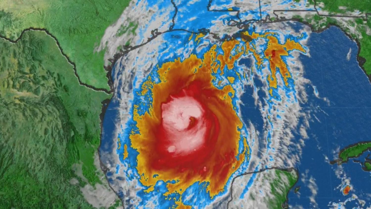
Hurricane Delta is making landfall this evening on the coast of Louisiana with 100 mph winds and a five to 10 foot storm surge near Morgan City. That storm will weaken rapidly tomorrow, but the leftover moisture may merge with the front south of New England Sunday.
That front then returns north as a warm front Sunday night and Monday with clouds bringing an increasing chance of showers during the day Monday.
It’s still a tough call, but it looks like we may get some appreciable rain as a front stalls over us here Monday night through Wednesday of next week. The temperatures are fluctuating up-and-down in our first alert 10 day forecast.