The NBC10 Boston and NECN weather team has issued a First Alert for Friday's winter storm, which could bring a widespread 6 to 12 inches of snow to parts of Massachusetts and the rest of New England.
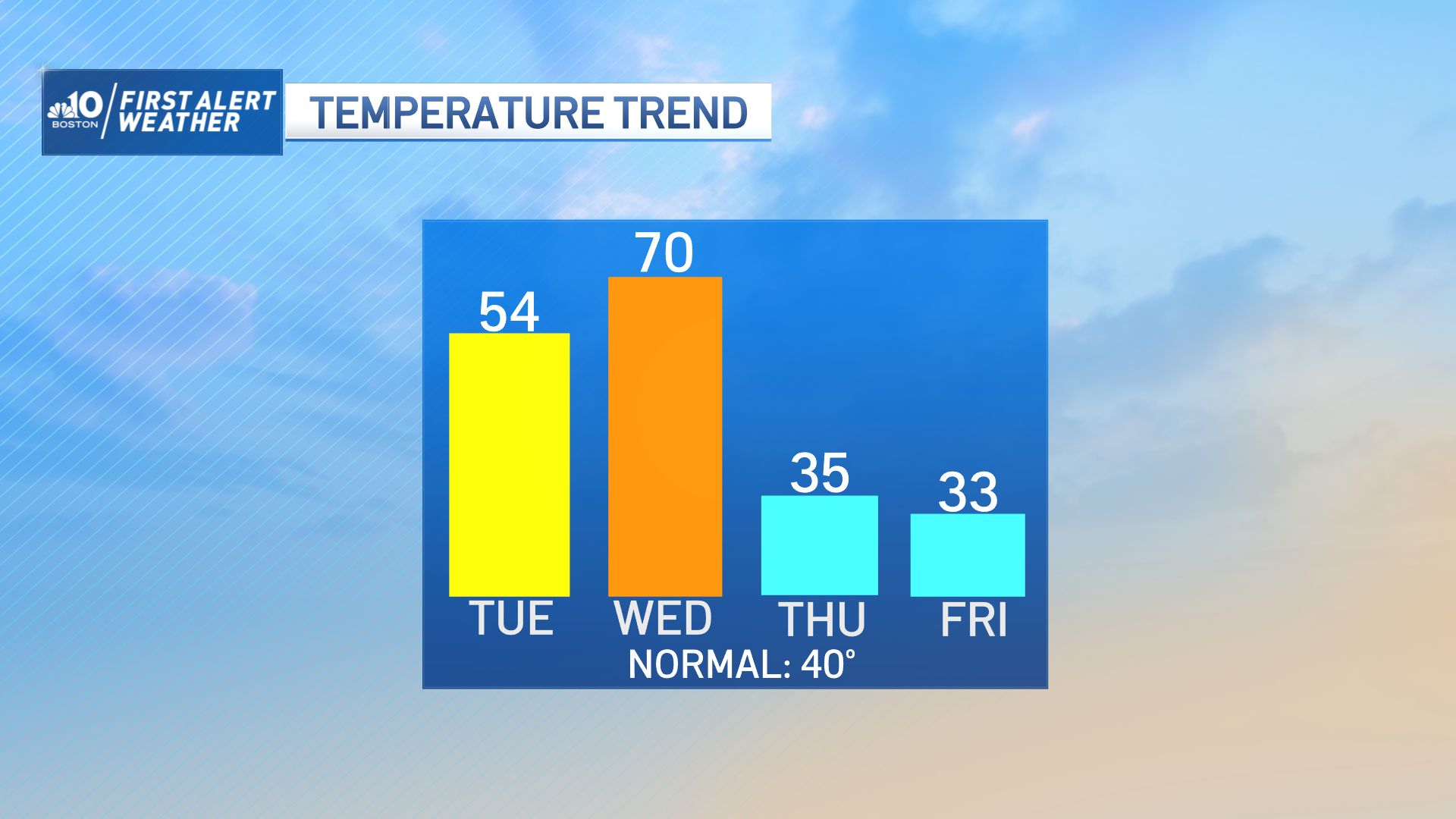
The storm is expected to arrive Thursday night and move out of our area later Friday, but not before causing some treacherous road conditions. It will represent a wild swing from Wednesday's forecast, when temperatures are predicted to approach 70 degrees in some areas.
Here's a look at what to expect as the storm rolls through New England, updated as of Tuesday morning:
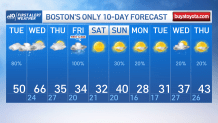
What does the 10-day forecast look like?
Get Boston local news, weather forecasts, lifestyle and entertainment stories to your inbox. Sign up for NBC Boston’s newsletters.
While our forecast for 60s continues for Wednesday, challenging already-warm record high temps for the date, our NBC10 Boston and NECN team also continues a First Alert for Friday for a winter storm. That 100% chance of precipitation hasn't wavered.
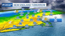
How high will temperatures get on Wednesday?
High temperatures Wednesday should soar into the 60s with an occasional sprinkle or light shower and breaks of sun. The records to beat are pretty warm -- Boston's record is 68 degrees from 2017, Manchester, New Hampshire, is also 68 degrees from 2017, Burlington, Vermont, from 2017 is 63 degrees and the record for Hartford, Connecticut, is 68 degrees from 1990.
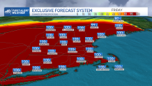
What's the chance of precipitation across New England from this storm?
The chance of precipitation (rain or snow -- in this case, snow to mix for many in southern New England and mostly snow north) has been pegged at approximately 100% from our in-house forecast system for days. This is not a storm where you wonder if it tracks out to sea; instead you watch the mix line.
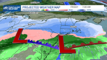
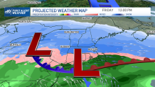
When will it start snowing in Boston?
The timing on Friday's system has been fairly consistent for days: arrival after midnight Thursday night/predawn Friday, snowing into Friday morning, then the mix line marches in from the south later in the morning to midday. But exactly where it stops is in question. Much of the day will be impacted.
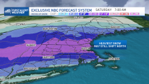
How much snow are we getting on Friday in Massachusetts?
This is our built-in-house forecast system snow projection -- this is NOT our final team forecast by any means, but it is the guidance we built here in Boston and take into account in our team forecasts. Think of this as us "pulling back the curtain" on an important tool we have in house. Tuesday, it's very similar to Monday, but our team believes the heavy snow zone may jog a bit farther north as more mix comes into the forecast for southern New England.
How much snow will fall where you live?
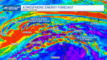
The atmospheric energy that will drive Friday's storm is over California and will dip over the Four Corners of southwestern U.S., then come to the Northeast by way of the Great Lakes. This is not a classic snowstorm track, and is more favorable for a burst of snow to mix, at least in southern New England, so watch the mix line.