
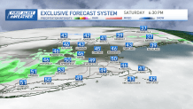
Here's a look at our early snow map for Tuesday
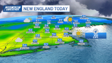
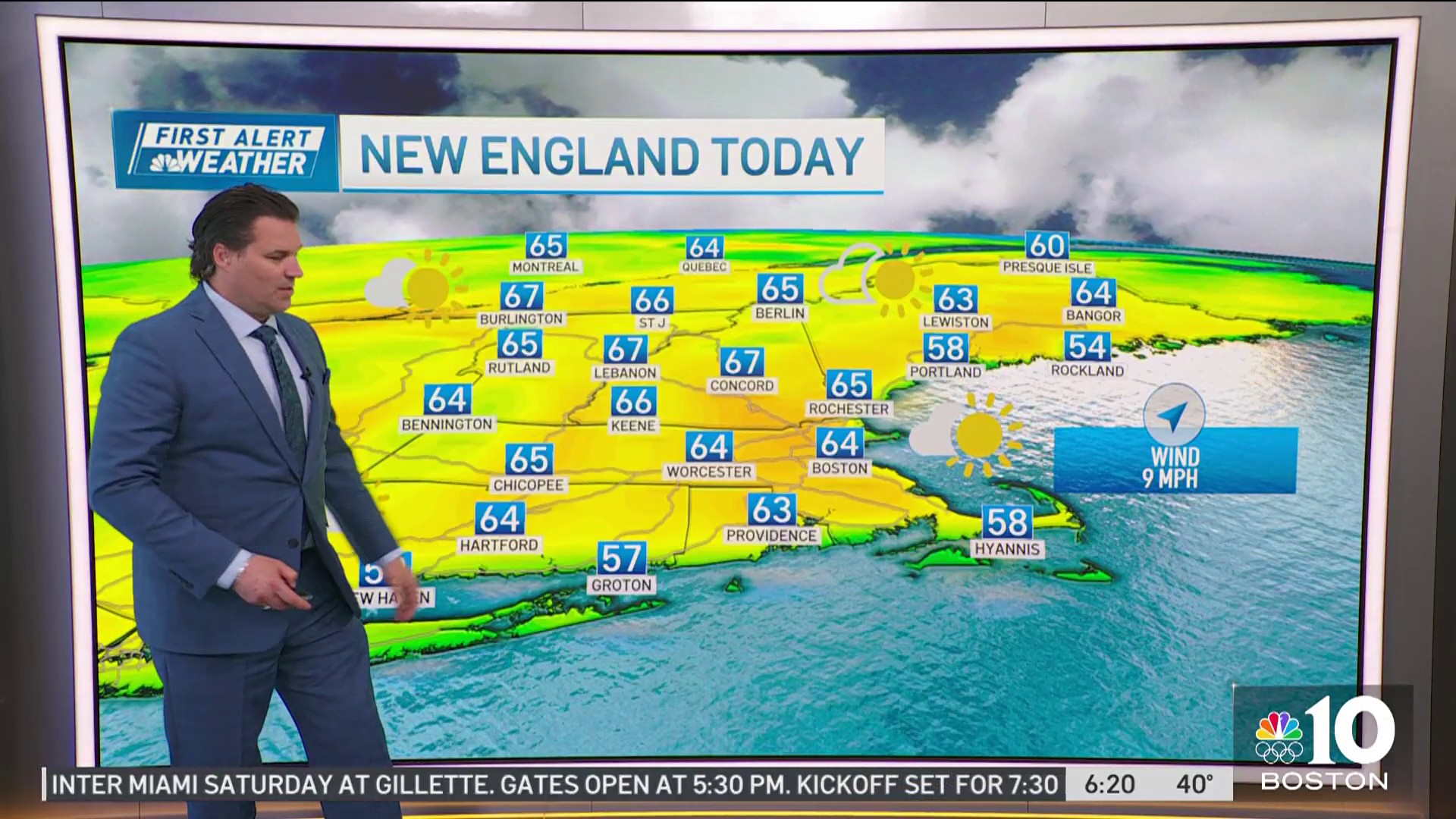
We’re on our way to a record warm afternoon as high temperatures reach the upper 50s to low 60s from Boston points south and west, and into the Merrimack Valley. The record high for today at Logan Airport is 60 degrees which was set back a year ago.
Get Boston local news, weather forecasts, lifestyle and entertainment stories to your inbox. Sign up for NBC Boston’s newsletters.
The region will be in and out of clouds this afternoon with temperatures reaching the upper 40s to low 50s north, mid to upper 40s in the south coast and Cape.
The best chance for precipitation will be across the north where we could see a few afternoon ‘hit & miss’ showers and sprinkles developing, mixed precipitation higher elevations, ahead of an approaching cold front.
Later this afternoon and evening that frontal boundary will pass through western areas of southern New England and Vermont triggering off a few more showers, perhaps an isolated rumble of thunder along with the isolated chance for small hail as well.
Most of those showers should dry up as they move eastward during the first half of the night leaving us with lots of clouds and cool temperatures. Lows temps fall back into the upper 30s south, low to mid 30s north.
Super Bowl Sunday will feature mild and dry conditions with clouds and sun, highs in the mid 40s to around 50. A tad cooler Monday with increasing clouds and highs reaching the mid 40s.
Weather

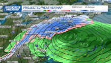
Monday night into Tuesday we’ll set our attention to a developing coastal storm which has the potential to deliver a heavy amount of snow to portions of the area. It’s a tricky forecast, seems like they all have been this year, but lack of cold air ahead of the system puts a bit of a challenge on forecasting snow totals at this point, as well as the question of the storm’s exact track.
All of this is being worked out, but forecast model trends have been consistently hinting at a colder scenario due to the storm’s rapid intensification which is expected to take place south of New England early Tuesday morning. Right now it looks like a good bet much of the Boston area will see a plowable amount of snow, with the highest totals inland.
A subtle shift in the track will make all the difference in expected snow totals, something we’ll be monitoring very closely as more information comes our way. Another aspect of this storm will be the potential for strong winds and coastal flooding as we find ourselves on the back end of an astronomical high tide cycle.
Beyond Tuesday, colder air will move in for the foreseeable future. Stay tuned for the latest updates!
Have a great Saturday!
