
Happy official first day of spring! We kicked off the season astronomically at 11:06 p.m. Tuesday night.
Unfortunately, it's two steps forward and one step back with spring around here. As we enjoyed spring weather last week, we're back to wintry weather the next several days. Wednesday is the warmest day for a while, then it turns blustery.
We're currently tracking snow squalls moving through Vermont, which could bring potentially dangerous driving conditions as visibility deteriorates. There have been reports of thundersnow in Bennington and Windham counties.
Get Boston local news, weather forecasts, lifestyle and entertainment stories to your inbox. Sign up for NBC Boston’s newsletters.
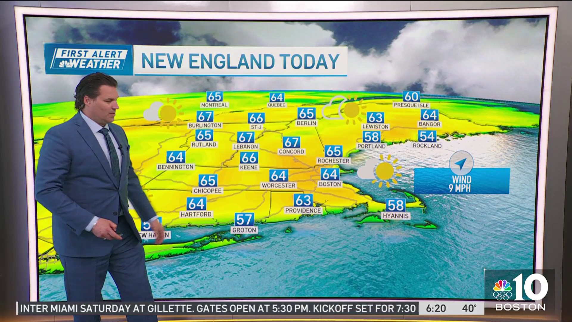
A warm front continues to move through New England, giving us some showers and highs in the 50s on a gusty southwest wind, before a cold front moves in Wednesday night.
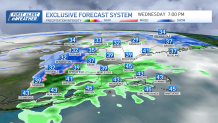
Snow possible Wednesday night
This will swing in some snow showers north and in higher elevations, to rain showers south around the evening commute. The wind increases behind the front, so by Thursday, we get a west wind gusting up to 40 miles per hour, highs in the upper 30s and wind chills in the 20s all day long.

Snow accumulation will be confined to high terrain and mainly in the mountains, where several inches can be expected late Wednesday into Thursday.
Weather

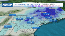
A coating of snow is possible just north and west of Boston overnight, with temperatures around freezing watch for slick spots Thursday morning. Maine will see over 6 inches of snow through Thursday as a low pressure system deepens over northern Maine, then moves out late Thursday.
Some snowflakes may mix around Boston briefly overnight as the system passes through and temps fall. Cooler temps remain for not only Thursday, but Friday, too.
Ho much snow will Mass., NH get this weekend?
The weekend brings us another chance for precipitation on Saturday. Snow to rain south, and snow in the mountains, rain south Saturday afternoon through night, as a low pressure system passes across southern New England.
Several inches of snow is likely in northern New England Saturday into Sunday morning. The timing and precipitation type is still to be determined this far out. The forecast models are split with the storm moving out by Sunday into Monday, but other models have the low stalling nearby with a chance for ice and rain Sunday into maybe the first part of next week.
