
As Hurricane Ian barrels into the Floridian coast, assured to be a catastrophic, damaging event given its tremendous Category 4/5 strength, here in New England, cool air continues to slowly advance out of Canada.
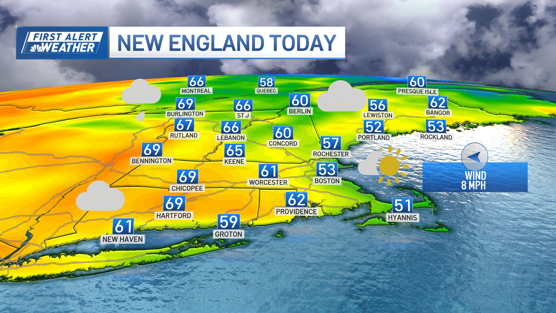
The same upper level disturbance that has been pinwheeling bundles of energy through our sky over the last few days will throw another one our way Wednesday afternoon. The result will be morning sunshine giving way to bubbling, puffy afternoon clouds that will deliver scattered showers to northern and western New England and afternoon sprinkles to southern New England.

Will Hurricane Ian Impact New England?
Get Boston local news, weather forecasts, lifestyle and entertainment stories to your inbox. Sign up for NBC Boston’s newsletters.
As the showers diminish Wednesday night, a clear sky and fall air will allow temperatures to fall into the 40s regionwide. Cool air will be in charge Thursday with high temperatures in the 50s north and 60s south with bright skies. Although Friday brings a continuation of dry and cool conditions, the northern shield of clouds from Hurricane Ian will arrive to southern New England with a veil of clouds dimming the sunshine by late day and those clouds will stay in New England all the way until next Tuesday!

The bulk of the rain associated with a decaying Hurricane Ian this weekend will assuredly stay south of New England. However, some showers will try to spread north, particularly by the time we get to Sunday and especially the farther south one is.
Weather Stories
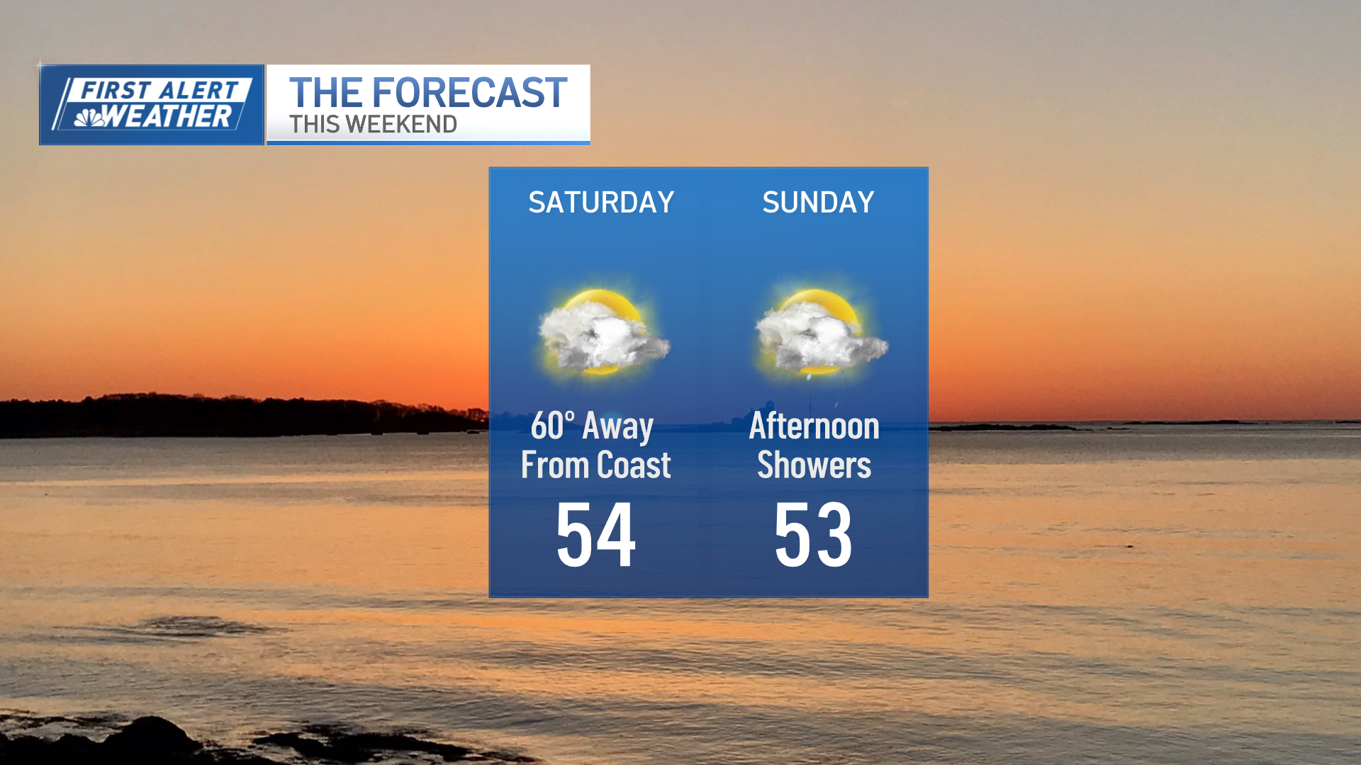
In fact, we maintain scattered showers in the forecast early next week as the moisture from Ian continues to lap across southern New England from the south. Cool fall temperatures remain dominant in the 10-day after our warmest day of near 70 degrees Wednesday.
