
As we head towards the end of the week, the weather forecast paints a picture of a dynamic and changing atmosphere, bringing a mix of mild temperatures, rain, and a return to cooler conditions.
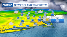
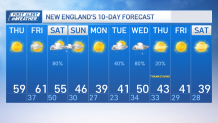
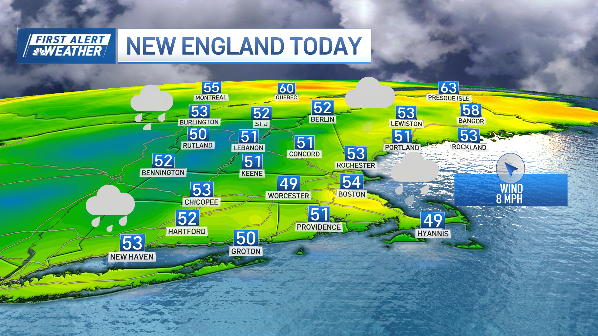
For now, dry weather will remain through Friday afternoon with temperatures about 10+ degrees over the normal accompanied by a noticeable increase for Friday. Highs are expected to reach well into the 60s on Friday, providing a temporary reprieve from the chill of mid-November. This warming trend is attributed to high pressure to the south of the region.
Thursday night promises clear skies and calm winds, allowing temperatures to dip into the 30s to lower 40s, with some urban areas possibly experiencing slightly milder conditions. Patchy ground fog or low clouds may make an appearance in typical spots, particularly in Rhode Island and southeastern Massachusetts.
Get Boston local news, weather forecasts, lifestyle and entertainment stories to your inbox. Sign up for NBC Boston’s newsletters.
Friday brings a shift in the weather pattern as a strong shortwave and cold front approach from the Great Lakes. Despite increasing clouds, the day is expected to be partly sunny and unseasonably mild, with highs reaching into the 60s.
The deeper moisture and precipitation associated with the approaching system are likely to hold off until later in the evening, maintaining a dry forecast during daylight hours.
Rain moves in mostly Friday night into Saturday as a coastal storm and a cold front make their way into the region. However, a recent eastward shift in the storm track has resulted in decreased rainfall amounts, providing some relief from initially anticipated impacts.
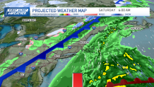
Rainfall amount may likely remain below half an inch.
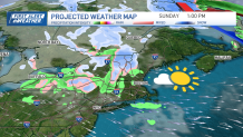
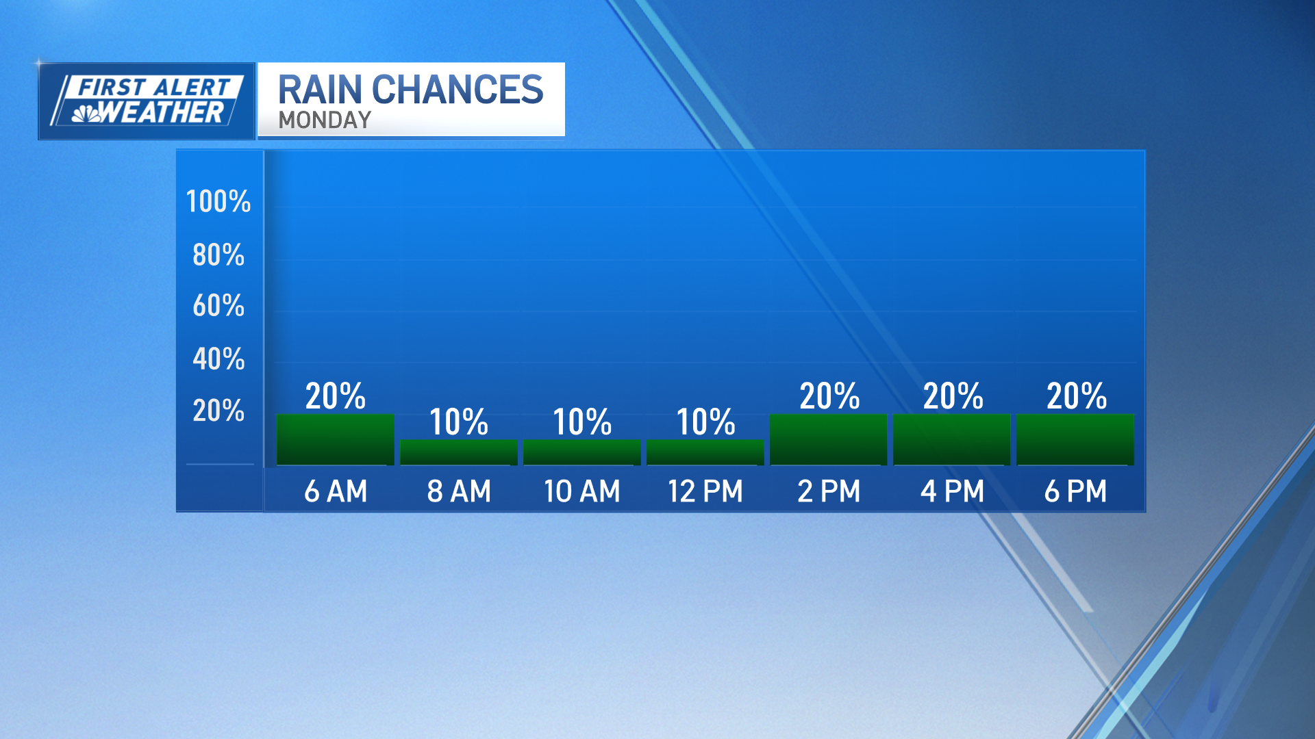
Following the rain, cooler and blustery conditions are set to prevail on Sunday and Monday, with temperatures trending several degrees below normal.
Surface high pressure will ensure dry weather through Tuesday, with a potential return of wet conditions on Wednesday as another low-pressure system approaches.
Weather Stories
This mid-week system may bring mostly rain, with a chance of wintry precipitation in higher elevations Wednesday into Thursday.
