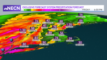
Another low pressure system is bringing showers over the area this evening, this time it’ll bring some strong winds into portions of New England along embedded downpours.
The strongest winds will likely gust near 60 mph in Vermont and central New England. Our southeastern shores could also see wind gusting close to 45 mph, for which our waves will see an impact of 7-10 ft high waves Thursday night.
A gale warning will remain in effect through Friday morning.
Back to our inland spots, we’ll keep on track with the overnight showers along periods of heavy rain with the chance of some thunder.
Get Boston local news, weather forecasts, lifestyle and entertainment stories to your inbox. Sign up for NBC Boston’s newsletters.
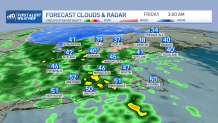
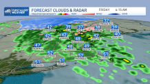
The placement of the strongest rainfall will track from southwest to northeast as the night progresses and by Friday morning most of those showers will be marching swiftly into the northeast.
Weather Stories
Our spots of heaviest rain may add up to an inch of total accumulations and isolated areas will even exceed that. While our early commute will likely be slowed down by the wet roads, we’ll watch rapid improvement in the south by late morning with a more significant sun appearance by lunchtime.
Maine will keep the scattered showers through much of the day before drier air fills in late Friday.
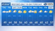
Keeping the sunshine involved through the afternoon, our highs will have the chance to rise to the 60s across the south. Northern New England will step up to the high 50s and a chance of some 60s depending on how early it clears up.
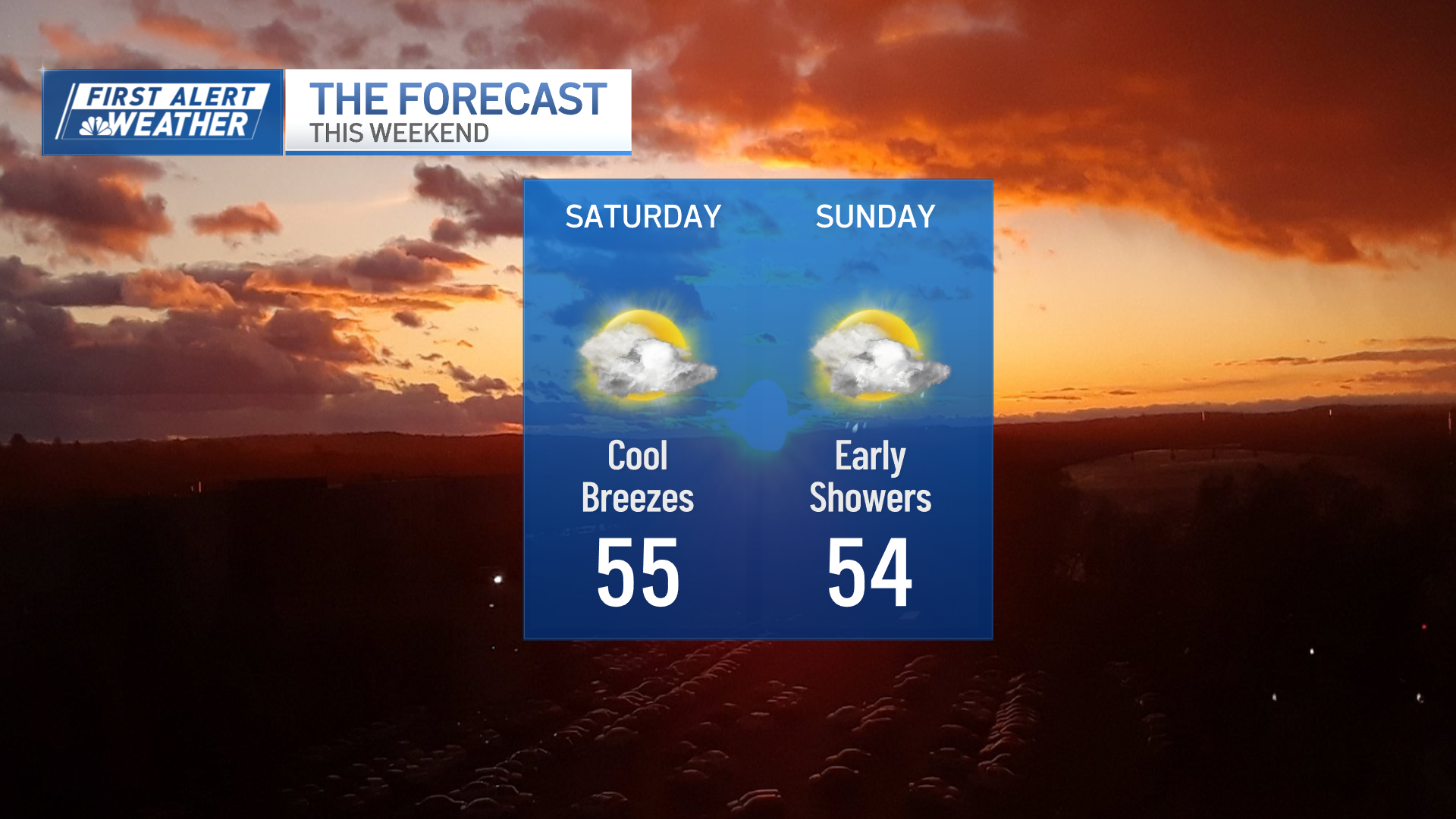
Our warm up wrap up what’s been an overall cool week, but our weekend features more scattered showers and the chance of some peeking sun.
More showers are likely for Saturday than Sunday in the Boston area but northern New England will have a higher chance to keep the rain for a bit longer. While it’s not a complete washout of a weekend, our skies will make the effort to make us rise to the upper 60s again next week.
A warm stretch will start Tuesday and hang on to the 60s through the end of next week.