
Skies briefly clear Tuesday morning to allow high temperatures to reach the 40s across the region as high pressure builds into the region from northern Maine. This will allow clouds to return back to the region during the afternoon as the wind turns to the east.
Temperatures may be marginally cold enough at elevations and north of the Mass. Pike for a light wintry mix during the day.
Moisture will remain shallow and the ice crystal layer may struggle to stay saturated. Any snow that occurs across northern/northwestern Massachusetts should be less than an inch, with perhaps some sleet mixed in. We’ll have to watch for pockets of light freezing drizzle as well.
Overnight, a weak low-pressure system will pass to our south. This system will bring spotty mixed precipitation showers. Low temperatures will hold in the low 30s to the low 40s.
A weak high-pressure system moves in behind the low on Wednesday, resulting in clear skies throughout the afternoon with high temperatures reaching into the mid-40s to low 50s. This will be the pick of the week as high-pressure nudges into our area from the Chesapeake Bay region.
Another low-pressure system begins to move into the area early Thursday. This system will be a bit stronger than the Tuesday’s and bring another chance for mixed precipitation showers. In the North Country, some higher peaks, as well as western Maine, may see up to six inches of snow.
A cold front will traverse across our area during the morning, resulting in high temperatures that will range from the low to mid-40s.
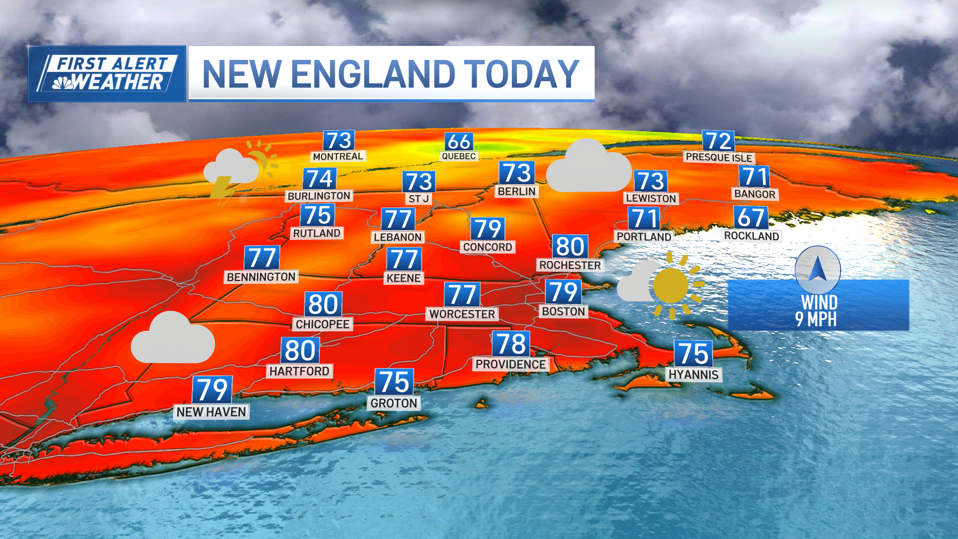
Weather Stories

Breezy conditions develop Thursday night along with low temperatures in the mid-teens to low 20s. Winds will gust 25 to 35 mph across the area, with higher gusts at about 45 mph across Cape Cod and the Islands. This combination of cold and wind will yield wind chill temperatures ranging from the single digits to below zero in northwestern and central Massachusetts.
Skies start to clear Friday morning, resulting in a dry but cool day with high temperatures only in the low to high 20s. High pressure builds into New England from the Great Lakes, resulting in mostly clear skies.
An area of high pressure will shift east of the area Friday night, bringing a return flow and warming temperatures back into New England. Despite this, overnight lows will dip into the single digits right to the coast, below-zero across the North Country.
Confidence continues to increase and a strong storm system will impact the Northeast over the weekend Saturday evening into Sunday morning. At this time, it appears that precipitation will fall as mostly snow across New England, with the exception of near the coast where a mixed bag of rain and snow is expected.
Snow will likely hold off during the day Saturday, starting closer to sunset. It is still too early to tell how much snow will fall and where the rain/snow line will set up.
Looking ahead to the start of next week, drier weather returns on the First Alert 10-Day Forecast on NBC10 Boston and necn for Monday as the low-pressure system lifts away from New England with cooler than normal temperatures remaining into the middle of the week.