
As promised, the colder air has arrived. More importantly, super cold air is above us right now.
That will foster cloud development, and with some snow showers reaching into western Massachusetts and Vermont from Lake Ontario, we could see a few flurries survive all the way to the Worcester Hills or southern New Hampshire later Tuesday afternoon.
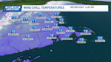
Wind chills remain on the cold side. They'll hover in the 20s for much of the day. However, with colder air moving in Tuesday night, wind chills will dip to the low and mid-10s by Wednesday morning.
Get Boston local news, weather forecasts, lifestyle and entertainment stories to your inbox. Sign up for NBC Boston’s newsletters.
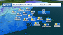
Highs, too, take a hit. We'll only see upper 30s along the coast, and mid-30s elsewhere. Another cold start is on tap Thursday morning before we start the warmup to cap the work week.
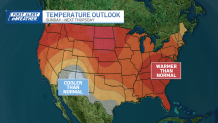
Shifting winds at all levels of the atmosphere will bring in the 40s and 50s by the end of week. Another fast-moving weather system should scoot through Friday night with a batch of rain.
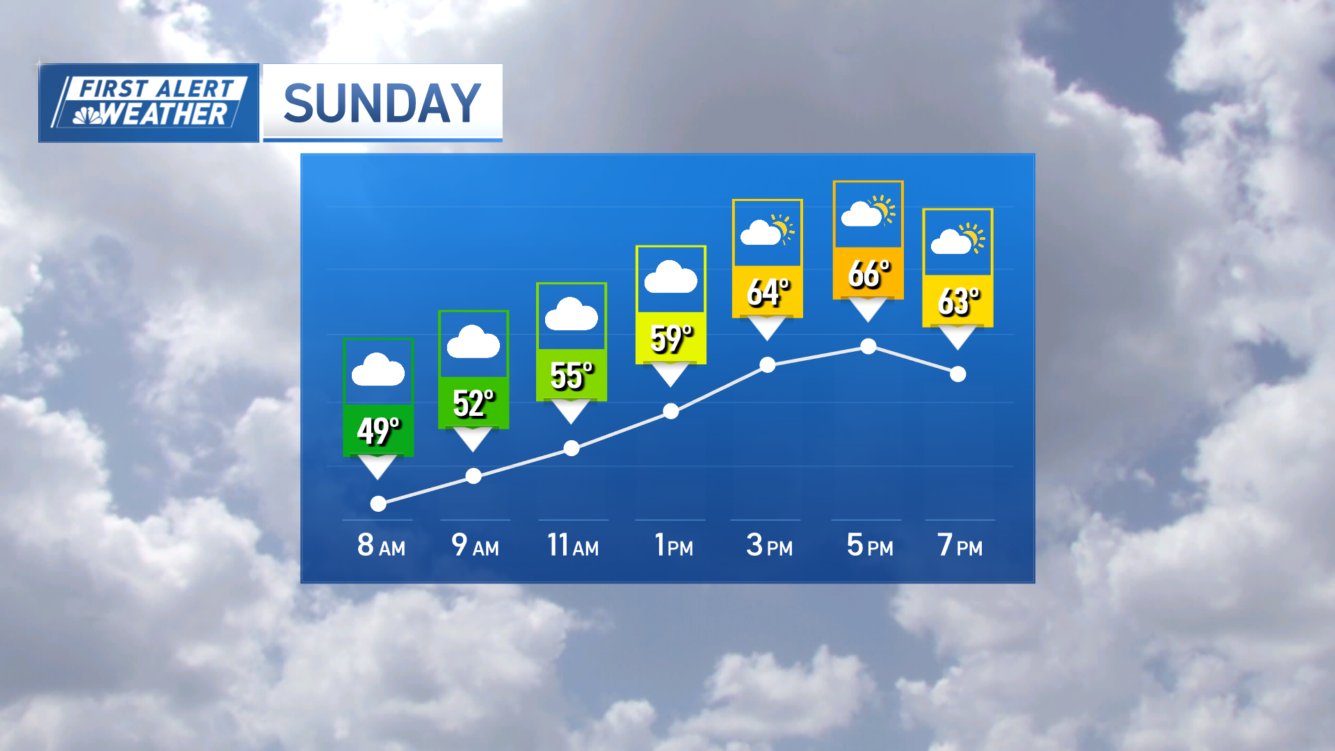
Right now, it appears the timing will be right for skies to brighten Saturday through at least Sunday morning. A much slower-moving storm will approach late Sunday night.
Some spots could be cold enough for some minor mix in northern, western, central Massachusetts and southern New Hampshire into Monday morning.
Weather Stories
This particular setup/storm will bear watching in later forecasts.
Stay warm!
