
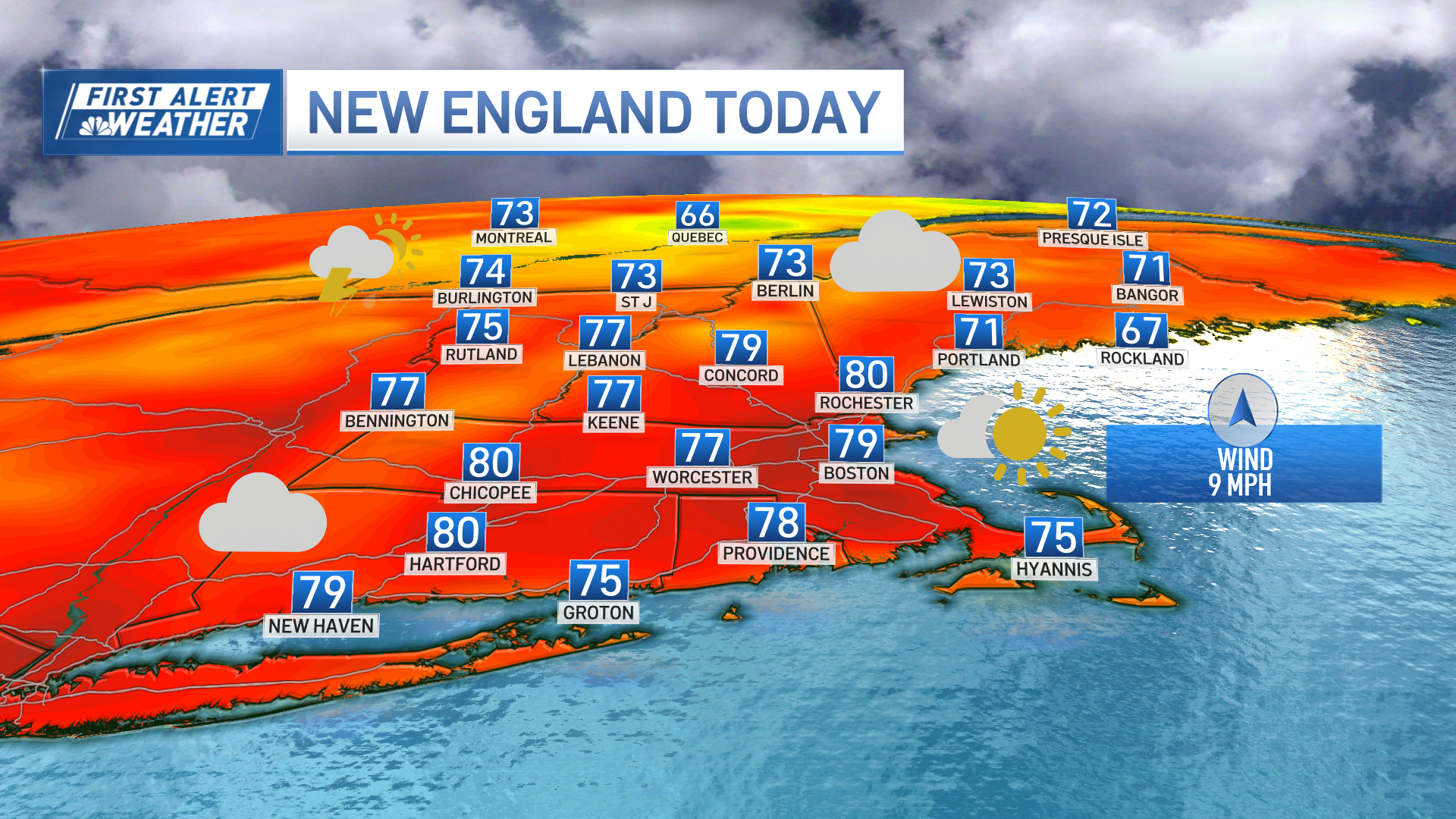
A stream of disturbances aloft is moving over New England Tuesday, dragging a ribbon of clouds southeast out of Canada to blot out the sun for the majority of the day, with only splashes and breaks of sun expected from time to time.
The air is still comfortable, though, dry in nature which not only allows temperatures to rise well into the 70s for most but the dry air also has meant these clouds have trouble producing more than a few sprinkles in the morning and evening.
Partial clearing Tuesday night will leave a blend of clouds and sun Wednesday, but the wind is likely to persist from the east and southeast, meaning the cool ocean water will influence not only immediate coastal communities but those farther inland as well, holding temperatures in the 70s for most and even some 60s for highs right at the beaches.
The delay in switching the wind to blow from the south means the air stays fairly comfortable Wednesday, with deeper humidity and warmth waiting until that wind switch overnight Wednesday night into Thursday when a morning shower is possible and an evening shower or thunderstorm should bubble up in the sticky air.
Friday brings drier air, though, interestingly, there’s not a lot of cooling expected so given the tendency for dry air to warm easier than humid air and expected sunshine, it’s entirely possible the day ends up warmer (and certainly should be brighter and much less humid) than Thursday’s muggy air.
This weekend, the jet stream wind – the fast river of air aloft that steers disturbances and separates northern cool air from southern warmth – will be flowing through the sky directly above New England, meaning any strong enough disturbances could touch off showers.
Weather Stories

At this early juncture, our First Alert Team sees a low chance for showers later Saturday and a more elevated, moderate chance of showers Sunday, with neither day at this point looking like a washout.
That said, the jet stream remains near to New England through the first half of next week, keeping an elevated chance of showers through the midweek and keeping us on guard for the potential of steadier or heavier rain if enough moisture should push north out of the Gulf of Mexico.
Temperatures this time of the year should normally reach the middle to upper 70s by days end, although we’ll have some days warmer than others, we don’t see any exceptional heat or chill in our exclusive First Alert 10-day forecast.