
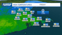
We're entering the warmup phase of this evolving pattern. Highs don't soar — yet. We're complicating things with an onshore breeze Thursday, so even though we see plenty of sun, we'll still "settle" for the low 40s.
Mid-40s are in play, however away from the coast.
That massive rain and windstorm that hobbled California a couple of days ago is at our doorstep Friday – in far weaker form. We'll see some lightweight showers roll through overnight on Saturday, but the mild air preceding the storm will be the headliner.
Get Boston local news, weather forecasts, lifestyle and entertainment stories to your inbox. Sign up for NBC Boston’s newsletters.
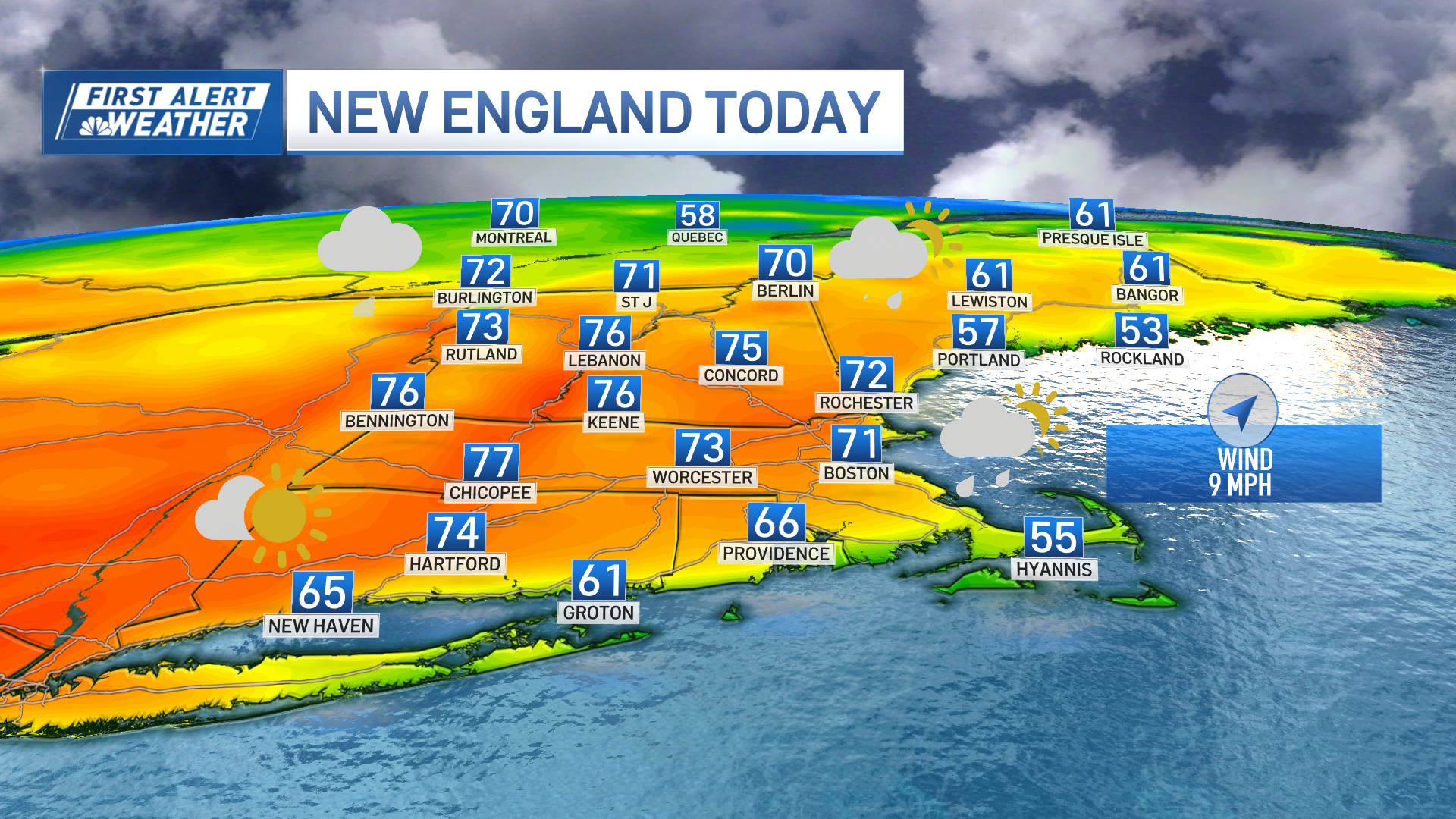
This is the day the temperatures soar, with highs climbing to near 60 degrees in spots, enough to set records around the region.
Boston and Worcester's high temperature records for Saturday were only set last year. How ironic that both winters have featured minimal snow and (possibly) set records on the same day (yes, weather is weird).
We'll start the cooldown on Sunday as we slide back to the upper 40s to low 50s.
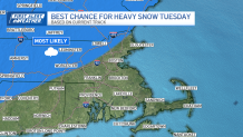
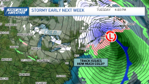
Then there's the storm next week. Right now, the timing appears to be late Monday into Tuesday. If we follow the drama arc of past storms, they start off looking like heavy snow everywhere nearly a week out, then gradually we sequester the heaviest amounts well inland from the coast.
This late in the season, let's cut to the chase. Without a lot of antecedent cold, it appears that the heaviest amounts could indeed fall from the Worcester Hills through the Merrimack Valley and into southern New Hampshire, far away from the mix and rain near the coast.
Sounds straightforward, eh? Admittedly it may not be. With a storm this size, there may be a lot of adjustments in the days ahead.
