
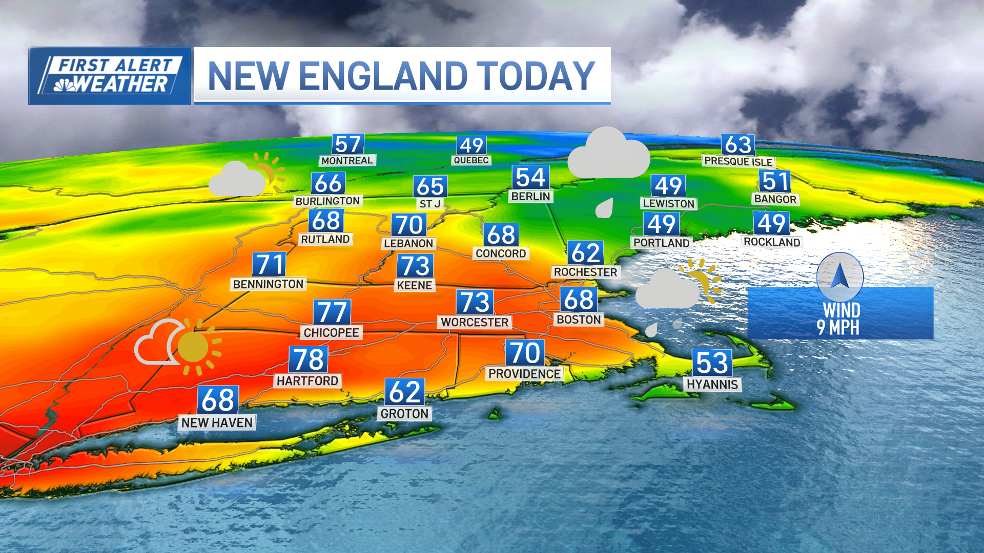
There's a ton of mild air flowing into New England this Tuesday morning, boosting our temperatures well into the 60s by this afternoon on the heels of a stiff southwest wind. This is a one-day foray into the mild air, as cold air is already rushing in across westernmost New York and southern Ontario.
That cold will sweep in Tuesday night, dropping us near freezing in many suburban towns and into the upper 30s in Boston. Winds will remain brisk and busy into Wednesday morning.

The cold that sets in Wednesday night and early Thursday is the main reason we're thinking some towns and cities may see mixed precipitation with our next weather system.
Get Boston local news, weather forecasts, lifestyle and entertainment stories to your inbox. Sign up for NBC Boston’s newsletters.
This isn't a strong nor a very juicy storm, but enough cold will be in place to give us a flair of things to come in the months ahead.

Most spots just see a brief mix of sleet and rain at the onset, but tough-to-dislodge cold in central/western Massachusetts and southern New Hampshire will create some minor accumulation that could create some isolated slippery spots in the hills and valleys.

This appears to be solely an early morning thing, as temperatures slowly climb above freezing by mid/late morning. No one is really seeing anything warm on Thursday, however, as highs settle for the upper 30s to low/mid 40s.
Weather Stories

We'll keep you apprised of the changes in the day(s) ahead. Early season weather systems of this nature can be pretty tricky to nail down when temperatures are marginal.
