
Much more comfortable air has moved in to New England from Canada. This ends our streak of day after day of sticky weather with scattered downpours and thunderstorms.
The upper level low pressure system that caused the crazy storms on Tuesday has now moved off to our east, and we get a couple of days of relief from the sticky weather.
Get top local stories in Boston delivered to you every morning. Sign up for NBC Boston's News Headlines newsletter.
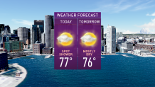
The air is still fairly cool up in the sky, so instability clouds are replacing the low overcast and locally clear sky we had Wednesday morning. Areas that started off sunny are turning partly sunny, and areas that started off cloudy are turning partly cloudy. There are a few spot showers and sprinkles, but no thunder is expected Wednesday. High temperatures will be near 70 degrees on the east facing shoreline, 80 to 85 degrees along and west of the Connecticut River Valley.
Wind is light and variable away from the coast but from the northeast gusting past 20 mph at the ocean, except along the south-facing shorelines it is a lighter wind.
Once again patchy fog will form overnight. Hopefully we get a few hours of clear sky to perhaps get a view of the comet Neowise in the northern sky.
Thursday is similar to Wednesday, with a mixture of sun and clouds, maybe a few sprinkles and probably a little less sunshine than we have on Wednesday. Temperatures will again be near 80 degrees west, and near 70 degrees at the beach, with a light wind from the east and southeast.
The next front arrives on Friday, with a lot of clouds and a chance of showers and thunderstorms and a high temperature closer to 80 degrees, with humidity returning.
Local
In-depth news coverage of the Greater Boston Area.


That front should move, out leaving us with a warm to hot weekend, Saturday will feature sun and clouds, with temperatures close to 90 degrees. Mostly sunny Sunday with a high temperature in the 90s. The next front comes in later Monday and Tuesday.
Some portions of New England may end up with a three-day heatwave before the next round of thunderstorms comes in early next week, as seen in our First Alert 10-day forecast.