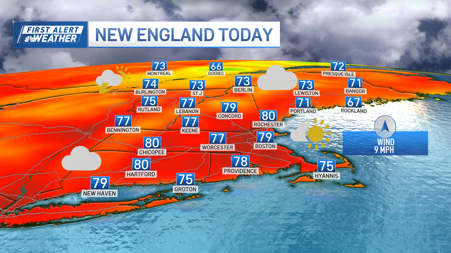
Low pressure slowly meandering south of New England Monday brought a threat for some spotty showers and downpours, mainly in southern New England.
It won’t be a washout by any means, but there will be some raindrops to dodge at times – so you may want to keep your umbrella handy.
STAY IN THE KNOW
Watch NBC10 Boston news for free, 24/7, wherever you are. |
|
Get Boston local news, weather forecasts, lifestyle and entertainment stories to your inbox. Sign up for NBC Boston’s newsletters. |
Central and northern New England are a bit more removed from the action, so just an isolated shower or rumble of thunder is possible Monday. Highs will be in the 70s and 80s from east to west respectively under variable clouds.
Tuesday, expect a similar start: lots of clouds, some patchy fog and a few showers south. The overall trend will be to decrease the cloud cover through the day, allowing for some instability to develop and, in turn, a few thunderstorms to pop in western New England. After that, it’s all about the heat and oppressive humidity.
Get top local stories in Boston delivered to you every morning. Sign up for NBC Boston's News Headlines newsletter.

Another heat wave is likely across much of the region Wednesday through Friday. The heat will peak Thursday and Friday, in the lower to middle 90s, with heat index values around 100 to 104 degrees. For that reason, we’ve got you in a First Alert for those days.
Along with the stifling heat, some scattered thunderstorm activity is anticipated as well.
Weather Stories

Relief will arrive this weekend as a cold front crosses New England Saturday, bringing an elevated chance of storms. Highs will be in the 80s both weekend days and dewpoints will drop to around 60.
High pressure will provide us with a pleasant stretch of summer days to kick of next week with bright skies and highs around 80.
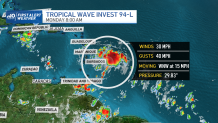
Meanwhile, in the tropics, an area of low pressure east of Barbados is showing signs of organization and may become a tropical depression by Monday night. This disturbance will eventually become the storm Fred, and is forecast to move near the Virgin Islands and Puerto Rico Tuesday and near Hispaniola around midweek.