Skip to content
Main Navigation
Search
Search for:
Local
Weather
Investigations
Videos
Sports
U.S. & World
Traffic
Newsletters
Live TV
Trending
24/7 streaming news
NFL Draft live updates
Celtics' playoffs
Karen Read trial
Trump trial
Paris Olympics
Ana Walshe podcast
Kwani Has Questions
@Issue
Expand
New England Patriots
23 mins ago
New QB Drake Maye introduced, ready to help Pats back to winning ways
Tom E. Curran
2 hours ago
With Drake Maye pick, the Patriots are betting on themselves
Boston
3 hours ago
Police bust ‘very sophisticated ring of homebreakers' that robbed South Asians' homes ...
Guns & Weapons
2 hours ago
TSA reviews airport security after Turks and Caicos ammo arrests
Danvers High School
1 hour ago
Man who killed Danvers teacher at 14 pleads guilty to 2014 attack on youth services wo...
Phil Perry
4 hours ago
Best available players for Patriots on Day 2 of 2024 NFL Draft
NFL Draft
3 hours ago
2024 NFL Draft Round 1 winners and losers: Falcons, QBs draw headlines
dorchester
3 hours ago
2 USPS mail carriers robbed in Dorchester
Boston
3 hours ago
Pro-Palestinian protests continue on college campuses across Boston
forecast
2 hours ago
Here's why we wake up to chilly mornings
Local
See all
New England Patriots
13 mins ago
2024 NFL mock draft: Expert predictions for Patriots' Day 2 picks
New England Patriots
53 mins ago
Watch Patriots call Maye on draft night in behind-the-scenes video
New England Patriots
2 hours ago
This stat will get Patriots fans excited about Drake Maye's potential
Most Read
Boston
Police bust ‘very sophisticated ring of homebreakers' that robbed South Asians' homes in Mass.
Danvers High School
Man who killed Danvers teacher at 14 pleads guilty to 2014 attack on youth services worker
north andover
Man dead after shooting at police in North Andover home standoff
travel
Mother's warning after son's 8-month Turks and Caicos prison sentence: ‘It's not behind us'
Boston
Pro-Palestinian protests continue on college campuses across Boston
travel
US tourists face 12 years in prison for accidentally bringing ammo to Caribbean island
Phil Perry
4 hours ago
Best available players for Patriots on Day 2 of 2024 NFL Draft
NFL Draft
3 hours ago
2024 NFL Draft Round 1 winners and losers: Falcons, QBs draw headlines
dorchester
3 hours ago
2 USPS mail carriers robbed in Dorchester
Boston
3 hours ago
Pro-Palestinian protests continue on college campuses across Boston
forecast
2 hours ago
Here's why we wake up to chilly mornings
Top Videos
See all
Karen Read Trial
See all
Karen Read
23 hours ago
Karen Read trial: Sides debate key issues as trial approaches
Karen Read
Apr 24
Karen Read trial: What's next now that the jury has been seated?
local
Apr 24
Jury selection continues in Karen Read trial
Patriots
See all
John's Sewer & Drain Cleaning
6 hours ago
Perry's Draft Grade: Pats get potential top 5 QB in Drake Maye
New England Patriots
1 hour ago
Report: Patriots have discussed Deebo Samuel trade with 49ers
New England Patriots
2 hours ago
Patriots take QB Drake Maye with No. 3 pick in 2024 NFL Draft
Hub Today
See all
Restaurants
23 hours ago
Blue Ribbon Brasserie's signature dishes
lifestyle
23 hours ago
Learning about the Big Queer Food Fest with Celebrity chef Tiffani Faison
South Boston
23 hours ago
Checking out The Playwright in South Boston
NBC Boston
23 hours ago
Bring Your Kid to Work Day
performance
23 hours ago
‘Hadestown' at the Boch Center Wang Theatre
Responds
See all
personal finance
3 hours ago
Financial literacy: What you need to know about common financial questions
Investigations
See all
nbc10 investigators
Jun 5, 2023
How to submit tips to the NBC10 Investigators
travel
18 hours ago
Mother's warning after son's 8-month Turks and Caicos prison sentence: ‘It's not behind us'
travel
18 hours ago
US tourists face 12 years in prison for accidentally bringing ammo to Caribbean island
investigations
Apr 11
Ipswich firefighter's overtime pay for hazmat response sparks controversy
Decision 2024
See all
Donald Trump
2 hours ago
Trump's lawyers seek to discredit testimony of former National Enquirer publisher in hush money trial
Tennessee
15 hours ago
Tennessee governor plans to sign bill that would let teachers carry guns in schools
Donald Trump
18 hours ago
Ex-National Enquirer publisher testifies he scooped up possibly damaging tales to shield Trump
@Issue
See all
@Issue
Apr 21
@Issue: Trump “hush money” trial underway
@Issue
Apr 14
@Issue: Biden allies hope abortion measures help beat Trump
@Issue
Apr 7
Addressing a mental health crisis in Boston
U.S. & World
See all
Biden Administration
41 seconds ago
Biden administration indefinitely postpones rule that would have banned menthol-flavored cigarettes
Israel-Hamas War
33 mins ago
As some universities negotiate with pro-Palestinian protesters, others quickly call the police
British Royal Family
12 mins ago
Britain's King Charles III will resume public duties next week after cancer treatment, palace says
Crime and Courts
43 mins ago
Arkansas woman pleads guilty to selling 24 boxes of body parts stolen from cadavers
2024 paris olympics
6 hours ago
Meet the Walmart deli employee who's also a track star hoping to make the Olympic team
News
Entertainment
See what gifts Beyoncé sent a 2-year-old fan after viral TikTok
4 hours ago
The TikTok law kicks off a new showdown between Beijing and Washington. What's coming next?
12 hours ago
Emma Stone says she'd love to be called by her real name at this point
16 hours ago
Boston Business Journal
The first apartments at Suffolk Downs can now be rented
Apr 19
Wayfair's first branded store has an opening date
Apr 18
Get a sneak peek inside F1 Arcade's new Boston location
Apr 18
Boston Restaurant Talk
Clover Food Lab emerging from bankruptcy with expansion plans
Apr 24
Grasshopper Vegan Restaurant in Allston is closing
Apr 24
Providence restaurant expanding into Cambridge: report
Apr 22
Celtics
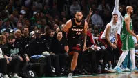
Rating Celtics concern levels in five areas after Game 2 loss to Heat
Watch
•
Apr 25
Celtics-Heat takeaways: Miami catches fire from 3 to even series
Watch
•
Apr 24
Eddie House: Celtics defense ‘a count late' in Game 2 loss to Heat
Watch
•
Apr 25
Red Sox
Cubs come to Boston to show Red Sox what a real rebuild looks like
Watch
•
5 hours ago
Red Sox place Brayan Bello on IL in latest blow to pitching staff
Watch
•
Apr 24
With shades of Ellsbury, Casas injury could be a killer for Red Sox
Watch
•
Apr 23
bruins
Brad Marchand's historic performance powers Bruins to Game 3 win
Watch
•
Apr 25
Game 3 takeaways: Special teams dominance lifts Bruins to 4-2 win
Watch
•
Apr 24
Why Bruins should go back to Jeremy Swayman in Game 4 vs. Leafs
Watch
•
Apr 25
Close Menu
Search for:
Meet the Team
Local
Weather
School Closings
Weather Alerts
Climate 2023
Investigations
NBC10 Boston Responds
Submit a tip
Video
Health
Traffic
NBC Sports Boston
Sports
Celtics
New England Patriots
Bruins
Red Sox
Entertainment
Hub Today
About NBC10 Boston
Our News Standards
TV Listings
Submit a Tip
Submit a Consumer Complaint
Submit Photos and Video
Newsletters
Download Our Apps
Cozi TV
Follow Us
Facebook
Instagram
TikTok
Contact Us
 Contact Us